At least six dead in Southern California flooding, mudslides

A search dog looks for victims in damaged homes after a mudslide in Montecito, California, U.S. in this photo provided by the Santa Barbara County Fire Department, January 9, 2018.

By Alex Dobuzinskis

LOS ANGELES (Reuters) – At least six people died and thousands fled their homes in Southern California on Tuesday as a powerful rainstorm triggered flash floods and mudslides on slopes where a series of intense wildfires had burned off protective vegetation last month.

The heavy downpours subsided early Tuesday after prompting evacuation orders for residents along the Pacific Coast north of Los Angeles, but forecasters warned of more rain throughout the day. Rainfall totals ranged from 2 inches to 4-1/2 inches (5 to 11 cm) in the area, said the National Weather Service.

At least six people died in the storm and mudslides in Santa Barbara County, the hardest-hit county in the region, incident command spokeswoman Amber Anderson said in a telephone interview. She did not specify the cause of the fatalities, but said they occurred in several locations in Santa Barbara where there were mudslides.

The threat of mudslides prompted the county to order 7,000 residents to leave their homes before the rains came and to urge 23,000 others to evacuate voluntarily.

Boulders block a road after a mudslide in Montecito, California, U.S. in this photo provided by the Santa Barbara County Fire Department, January 9, 2018.

Boulders block a road after a mudslide in Montecito, California, U.S. in this photo provided by the Santa Barbara County Fire Department, January 9, 2018. Mike Eliason/Santa Barbara County Fire Department/Handout via REUTERS

The county set up an evacuation shelter at Santa Barbara City College, and also gave residents a place to take their animals. The weather in Southern California was mild this week, so residents who fled their homes did not have to endure the cold snap that has gripped the U.S. Midwest and East Coast in recent weeks.

A neighborhood in the upscale community of Montecito, where mudslides ravaged homes near the city of Santa Barbara, residents had not been put under mandatory evacuation orders before mud from a creek cascaded toward their homes, Anderson said.

But she could not immediately say whether any of the fatalities were in the area that was not evacuated.

An unknown number of people in the county were unaccounted for, Anderson said, and 25 residents have been injured.

Photos posted by the local fire department showed a teenager covered in black mud being led away from the rubble of a house that had been destroyed by the Montecito mudslide. She had been trapped in the home for hours before rescuers came to her aid, the Santa Barbara County Fire Department said on Twitter.

Other pictures showed ankle-deep mud, logs and boulders in residential areas.

Emergency workers, using search dogs and helicopters, have rescued dozens of people stranded in rubble, Anderson said.

Emergency personnel search through debris and damaged homes after a mudslide in Montecito, California, U.S. in this photo provided by the Santa Barbara County Fire Department, January 9, 2018.

Emergency personnel search through debris and damaged homes after a mudslide in Montecito, California, U.S. in this photo provided by the Santa Barbara County Fire Department, January 9, 2018. Mike Eliason/Santa Barbara County Fire Department/Handout via REUTERS

Last month’s wildfires, the largest in California history, left the area vulnerable to mudslides. The fires burned away grass and shrubs that hold the soil in place, and also baked a waxy layer into the earth which prevents water from sinking deeply into the ground.

The overnight rains forced road closures, including a 30-mile (48-km) stretch of U.S. Highway 101, essentially cutting off traffic between Santa Barbara and Ventura counties northwest of Los Angeles. Ventura County escaped with little damage, the county sheriff’s office said.

(Additional reporting by Peter Szekely in New York and Brendan O’Brien in Milwaukee; editing by Jeffrey Benkoe and Jonathan Oatis)

Thousands in California flee homes ahead of possible mudslides

California wildfire fight aided by better weather

(Reuters) – Thousands of Southern Californians fled their homes on Monday as a powerful rain storm that could cause flash floods and trigger mudslides soaked steep slopes where a series of intense wildfires burned off vegetation last month.

Heavy downpours that could produce more than 1 inch (2.5 cm) of rain per hour were expected through Tuesday evening, forcing officials to order or advise Ventura, Santa Barbara and Los Angeles county residents who live near where wildfires burned to evacuated their homes.

“Recent burn areas will be especially vulnerable where dangerous mud and debris flows are possible,” the National Weather Service said in a statement.

Several December wildfires, included a blaze known as the Thomas Fire which was the largest in the state’s history, burned away vegetation that holds the soil in place and baked a waxy layer into the earth that prevents water from sinking deeply into the ground.

About 30,000 residents were under evacuation orders or advisories on Monday, ABC news reported.

“I’m just tired. I can’t seem to get my life kick-started,” Teri Lebow, whose Montecito, California was damaged by the wildfires, told the Los Angeles Times.

The storm system was expected to produce 4 inches to 7 inches (10 to 18 cm) in the foothills and mountains with 9 inches (23 cm) in isolated areas. Three inches (7 cm) to two feet (61 cm) of snow was also forecast for higher elevations, the National Weather Service said.

(Reporting by Brendan O’Brien in Milwaukee; Editing by Robin Pomeroy)

Storms slam U.S. Southeast as bitter cold drags on

A woman stops to photograph the frozen Josephine Shaw Lowell Memorial Fountain in New York, U.S., January 3, 2018.

By Brendan O’Brien

(Reuters) – Winter storms swept up the U.S Southeast toward New England on Wednesday as snow, freezing rain and strong winds added to record-shattering cold that had much of the eastern United States in its grip.

The wintry mix and low wind chills could cause widespread power outages and leave roads icy, making commuting treacherous for millions of Americans from northern Florida to southern Virginia, the National Weather Service said in a series of warnings.

Some schools and universities in those states were closed on Wednesday in anticipation of the storm. Many flights out of the Savannah/Hilton Head International Airport in Georgia and Tallahassee Airport in Florida were canceled.

The weather service said its Tallahassee office measured a snow and sleet accumulation of 0.1 inch (2.5mm) on its roof early in the day, the first time Florida’s capital has had snow in nearly 30 years.

The service said travel in northeastern Florida was likely to be difficult and dangerous.

Two to 3 inches of snow was expected in northeastern Florida, coastal Georgia and South Carolina, according to early morning forecasts, said weather service meteorologist Bob Oravec.

Some Florida and Georgia residents shared images on social media of light snow accumulating.

“So a #SnowDay in #Florida. We know hurricanes. Snow? Not sure what to do here. How do you luge?,” wrote one Twitter user, @thejalexkelly.

On Tuesday, Florida Governor Rick Scott urged residents in the north of the state to brace themselves for the cold. He said cold weather shelters have either opened or would be opened in 22 of the state’s 67 counties.

Some coastal areas of Georgia, South Carolina, North Carolina and Virginia could ultimately receive up to 6 inches (15 cm) of snow, along with an accumulation of ice, while parts of New England could see 12 to 15 inches (30-38 cm) of snow and wind gusts of 35 miles per hour (55 km per hour) by the end of week, the weather service said.

Late on Tuesday, Georgia Governor Nathan Deal declared a state of emergency for 28 of the state’s 159 counties.

As the storm bears down, an arctic air mass will remain entrenched over the eastern two-thirds of the country through the end of the week, forecasters said. The record-low temperatures were to blame for at least eight deaths in Texas, Wisconsin, West Virginia, North Dakota and Michigan over the past several days, officials said.

A large swath of the Midwest was under a wind chill warning on Wednesday as places like Cleveland and Indianapolis had temperatures in the wind of 5 to 20 degrees below zero in Fahrenheit (minus 20 to minus 29 degrees Celsius), while the Deep South faced deep-freeze temperatures that threatened crops and pipes, the weather service warned.

(Reporting by Brendan O’Brien in Milwaukee; Additional reporting by Gina Cherelus in New York; Editing by Jeremy Gaunt and Jonathan Oatis)

Record-shattering cold reaches into Florida

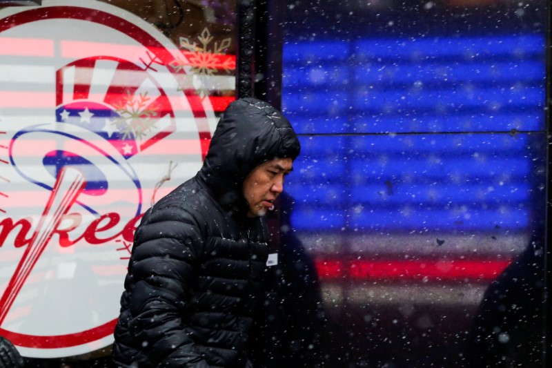
A man walks in falling snow at Times Square as a cold weather front hits the region, in Manhattan, New York, U.S., December 30, 2017.

By Ian Simpson

(Reuters) – Record-shattering arctic cold reached as far south as Florida on Monday with freeze warnings in place from Texas to the Atlantic Coast and the Northeastern United States facing another cold wave at the end of the week, forecasters said.

Temperatures ranged from 20 to 30 degrees Fahrenheit (11 to 17 degrees Celsius) below normal across the United States east of the Rocky Mountains, with only southern Florida untouched by the arctic blast.

“That degree of cold will be with us until tomorrow,” said Brian Hurley, a National Weather Service meteorologist at College Park, Maryland. “Tuesday morning, we’re looking at temperatures with very high probability of record lows.”

Along Alabama’s Gulf Coast, the temperature in the city of Mobile could hit a low of 16 F (minus 9 C) overnight. Stiff breezes were expected to create dangerously cold wind chills across southeastern Georgia and most of northeastern Florida, the weather service said.

Michael Kimberl, co-founder of Sean’s Outpost, an encampment for homeless people in Pensacola, Florida, said he was handing out propane fuel and extra blankets to residents.

“Our community is very unequipped for weather of this type,” he said by phone. Homeless shelters were also making special accommodations, including one site available for women and children, he said.

The mass of frigid air pumped south by a dip in the jet stream sent temperatures plunging across the U.S. heartland. Omaha, Nebraska, posted a low of minus 20 F (minus 29 C), breaking a 130-year-old record, and Aberdeen, South Dakota, shattered a record set in 1919 with a temperature of minus 32 F (minus 36 C).

The cold will be unrelenting across the Middle Atlantic and Northeastern United States, with up to two dozen low-temperature records expected in those regions over the next day or two, Hurley said.

Although the cold should ease across most of the United States after Tuesday, the northeastern quarter of the country will see a repeat of the frigid temperatures from Thursday to Friday as another arctic blast hits the area.

The private AccuWeather forecaster said the cold snap could combine with a storm brewing off the Bahamas to bring snow and high winds to much of the Eastern Seaboard as it heads north on Wednesday and Thursday.

The only part of the United States spared the deep freeze is the Southwest, with above-normal temperatures and dry weather expected to linger there, the weather service said.

(Reporting by Ian Simpson in Washington; Editing by Jonathan Oatis and Peter Cooney)

Deep freeze keeps grip on eastern United States; four die

Elena Barduniotis from Colorado waits in Times Square ahead of New Year's celebrations in Manhattan.

By Brendan O’Brien

MILWAUKEE (Reuters) – A record-shattering Arctic freeze kept its grip on much of the United States east of the Rocky Mountains on Tuesday but temperatures everywhere except the Northeast were expected to warm within 24 hours.

Many school districts shut their classrooms due to the cold snap, which claimed four lives over the long New Year’s weekend.

The National Weather Service issued wind chill warnings for Tuesday as dangerously low temperatures were due from eastern Montana across the Midwest into the Atlantic coast and the Northeast and down through the deep South.

School districts in Iowa, Massachusetts, Indiana, Ohio and North Carolina canceled or delayed the start of classes as bitterly cold temperatures, 20 degrees to 30 degrees Fahrenheit (11 to 17 degrees Celsius) below normal, were expected across the eastern half of the United States.

“Just the bitter cold which is just too dangerous to put kids out on the street waiting for a bus that may not come,” Herb Levine, superintendent of the Peabody Public Schools, north of Boston, told a local CBS affiliate television station.

The cold was blamed for the deaths of two men in separate incidents in Milwaukee, according to the Milwaukee Journal Sentinel. A homeless man was found dead on a porch in Charleston, West Virginia, while another man was found dead outside a church in Detroit and police said he may have froze to death, local news outlets reported.

Washington Mayor Muriel Bowser urged residents to call the city if they saw people outside.

“We want every resident to have shelter and warmth,” she said in a tweet.

Many places across the United States experienced record low temperatures over the last few days. Omaha, Nebraska, posted a low of minus 20F (minus 29C), breaking a 130-year-old record, and Aberdeen, South Dakota, shattered a record set in 1919 with a temperature of minus 32F (minus 36C).

The cold should ease across most of the country after Tuesday, but the northeastern section of the country will see a repeat of the frigid weather on Thursday or Friday as another arctic blast hits the area.

Private AccuWeather forecaster said the cold snap could combine with a storm brewing off the Bahamas to bring snow and high winds to much of the Eastern Seaboard as it heads north on Wednesday and Thursday.

(Reporting by Brendan O’Brien in Milwaukee; Editing by Raissa Kasolowsky and Jeffrey Benkoe)

Land of the freeze: arctic wave hits U.S. Midwest, Northeast

Trees are seen after the record snowfall in Erie, Pennsylvania, U.S., December 26, 2017 in this picture obtained from social media. Picture taken December 26, 2017.

By Gina Cherelus

NEW YORK (Reuters) – Most of the U.S. Northeast and Midwest grappled with a post-Christmas deep freeze on Thursday, with temperatures expected to plunge as low as minus 20 degrees F (minus 29 C) in North Dakota as forecasters warned that the harsh winter weather could usher in the New Year.

Tioga, about 200 miles (322 km) north of Bismarck, took honors as the coldest spot in the continental United States, according to National Weather Service (NWS) spokesman Bob Oravec. The mercury dived to minus 15 F early on Thursday afternoon.

“By tomorrow morning, low temperatures will probably be 15 to 20 degrees below zero in the northern and northwestern areas of North Dakota, maybe even in north Minnesota,” Oravec said.

On Wednesday, International Falls, Minnesota, about 300 miles north of Minneapolis, lived up to its reputation as the “Icebox of the Nation.” The low temperature there dropped to 37 degrees F below zero, breaking the old record for the day of 32 degrees below, set in 1924. Temperatures moderated to minus 2 F on Thursday.

Mayor Bob Anderson told Reuters that a local paper mill had to reduce operations because of the cold. But he said mail was still being delivered, and the town’s roughly 6,000 weather-hardened residents were taking the cold in stride.

For most of the region encompassing New England, northern Pennsylvania and New York, the NWS issued wind chill advisories or warnings. Temperatures in the region ranged from highs in the teens and 20s F to lows in the single digits or below zero.

For upstate New York, east of Lake Ontario, the NWS warned of “dangerously” cold wind chills of minus 5 F to minus 30 F through Friday. In northern Vermont, conditions are even more brutal, with wind chills threatening to bottom out at minus 40 F.

On Twitter, the hashtag #ItsSoCold was the No. 1 trending topic in the United States on Thursday as social media users expressed their frustration with Old Man Winter.

“When your landlord doesn’t have the heat on during the workweek so the cat sitting in your lap isn’t just cute, but also practical. #ItsSoCold,” wrote user Walton Clark on Twitter.

Erie, a city of about 100,000 on the shores of Lake Erie in northwest Pennsylvania, was expecting a fresh round of winter storms that could bring as much as an additional 10 inches (25 cm) of “lake effect” snow, forecasters said. The area is already buried under more than 65 inches from a record-breaking storm earlier this week.

The accumulations, heavy even by the standards of the Great Lakes’ eastern shores, resulted from a wave of Arctic air moving across the relatively mild waters of the lake, forecasters said.

Light and heavy snow was also expected to fall this weekend in many other parts of the United States, from Montana to Maine, forecasters said.

(Reporting by Gina Cherelus in New York; Additional reporting by Chris Kenning in Chicago; Editing by Matthew Lewis)

Erie, Pennsylvania, buried under record snowfall, ” a crippling snow event”

Silas Stueve plays in the snow after two days of record-breaking snowfall in Erie, Pennsylvania, U.S., December 27, 2017.

By Jon Herskovitz

(Reuters) – A storm that has dumped more than 65 inches (165 cms) of snow this week on Erie, Pennsylvania, is expected to slightly taper off on Wednesday after leaving drifts that buried cars, paralyzed the area and made the county declare an emergency.

A general view of 1925 State Street after the record snowfall in Erie, Pennsylvania, U.S., December 26, 2017 in this picture obtained from social media.

A general view of 1925 State Street after the record snowfall in Erie, Pennsylvania, U.S., December 26, 2017 in this picture obtained from social media. Courtesy of Instagram @BLJEFFERYS /via REUTERS

But the respite for Erie, a city of about 100,000 in northwest Pennsylvania on the shores of Lake Erie, is expected to be short-lived, with a fresh round of winter storms coming Thursday night predicted to bring as much as 10 inches more snow, forecasters said.

“This is a crippling snow event,” said Zach Sefcovic, a meteorologist with the National Weather Service in Cleveland.

“They are no strangers to snow in that part of the state, but this much snow in that short a time is just unprecedented,” he said in a telephone interview.

Large parts of the United States were gripped by freezing weather, with an area stretching from Montana to Maine expected to see temperatures below 10 degrees Fahrenheit (-12.2 degrees Celsius) early on Thursday, the National Weather Service said.

People help dig out a car from a parking spot after two days of record-breaking snowfall in Erie, Pennsylvania, U.S., December 27, 2017.

People help dig out a car from a parking spot after two days of record-breaking snowfall in Erie, Pennsylvania, U.S., December 27, 2017. REUTERS/Robert Frank

The winter blast in Erie was caused by cold Arctic air moving over the lake, which had relatively mild water temperatures, forecasters said.

The storm broke a 59-year-old record for a two-day snowfall in Pennsylvania, topping the 44 inches that fell in 1958. Erie County Executive Kathy Dahlkemper issued a temporary disaster emergency declaration that mobilized resources to help the area.

Pictures of residents on social media showed drifts reaching beyond window-levels in houses and people clearing paths through chest-high accumulations.

“Out of Doritos. Family is arguing. Dogs are getting ornery. It’s been 3 days since my last chicken wing. We are out of whiskey,” wrote Nicole Massari on her Instagram account @theworldaroundnikki, along with a video showing her Pennsylvania home surrounded by snow.

Pennsylvania Governor Tom Wolf deployed 21 Pennsylvania National Guard troops along with some all-terrain military vehicles to the region on Tuesday to help residents dig out and transport emergency responders around the area.

Erie resident Brian Sheridan on Wednesday posted a photo on social media showing the top of his mail box peeking out underneath a mound of snow. In a caption, he wrote: “At this point, it just might be easier to put a hold on our mail until spring.”

(Reporting by Jonathan Allen in New York and Jon Herskovitz in Austin, Texas; Additional reporting by Lisa Maria Garza in Texas; Editing by Steve Orlofsky and Andrew Hay)

Erie, Pennsylvania pummeled by record 5 feet of snow

A general view of 1925 State Street after the record snowfall in Erie, Pennsylvania, U.S., December 26, 2017 in this picture obtained from social media.

(Reuters) – Snow piled up in Erie, Pennsylvania, on Wednesday after two days of record-breaking snowfall that had already surpassed 5 feet (1.5 meters), breaking city and state records, according to the National Weather Service.

Though residents are used to winter snow squalls blowing in from adjacent Lake Erie, which straddles the border with Canada, the Christmas storm is already one for the ages.

“This is an incredible amount of snow that we’re trying to move,” the Erie Police Department said in statement after the city declared a “snow emergency” on Tuesday, imploring people to stay off the streets.

By Tuesday evening, meteorologists had counted at least seven different city and state records broken by the storm.

The 34 inches (0.86 meters) that fell on Christmas Day alone was a new record for any single day in Erie, handily beating the 20-inch record set back in 1956, the National Weather Service said.

And the storm broke a 59-year-old record for two-day snowfall recorded anywhere in Pennsylvania, totaling 58 inches when Tuesday’s barrage was added and beating the 44-inch record set in Morgantown in 1958.

Another two to four inches of snow were forecast for Wednesday, with up to 6 inches in some places.

No residents of Erie, a city of 99,000 people according to recent U.S. census estimates, have been publicly reported as being injured in the storm, though some have complained to local news outlets about how long it takes to shovel out their driveways this week.

Pennsylvania Governor Tom Wolf deployed 21 Pennsylvania National Guard troops along with some all-terrain military vehicles to the region on Tuesday to help residents dig out, check on people’s well-being and transport emergency responders around the area.

(Reporting by Jonathan Allen in New York; Editing by Steve Orlofsky)

California wildfire crews gain edge as winds weaker than feared

Firefighters keep watch on the Thomas wildfire in the hills and canyons outside Montecito, California, U.S., December 16, 2017.

By Steve Gorman

LOS ANGELES (Reuters) – Firefighters gained an edge in their weeks-long battle against a sprawling wildfire in Southern California on Thursday, thanks to weaker-than-expected winds that have been driving the flames.

Firefighters halted the spread of the so-called Thomas fire, the second-largest in the state’s recorded history, at 272,200 acres (110,155 hectares) after carving containment lines around 60 percent of its perimeter over the last couple of days, fire and police officials said.

Wind gusts expected to accelerate to 50 miles per hour (80 km per hour) on Thursday morning, creating extreme fire danger conditions for Santa Barbara County, turned out to be weaker than feared, authorities said.

“On the beach side, we didn’t really see the winds that were predicted,” said California Department of Forestry and Fire Protection spokesman Brandon Vaccaro.

Ventura County, which has taken the brunt of the blaze, was now forecast to have peak winds of 40 mph (64 kph) down from an earlier top forecast of 50-mph (80-kph) winds on Friday, the National Weather Service said.

Firefighters have been able to secure the Santa Barbara side of the fire, Battalion Chief Chris Childers of the Santa Barbara County Fire Department said during a community meeting on Wednesday night.

“This has been a nightmare of a fire for a lot of people,” he said.

With progress being made against the blaze – which has scorched the dry coastal mountains, foothills and canyons of Ventura and Santa Barbara counties northwest of Los Angeles – officials said they had cut the number of firefighters to 5,644 from a peak of 8,500 over the past few days.

The Thomas blaze, which became California’s second largest wildfire in state history on Tuesday, is nearly as large as the 2003 Cedar fire in San Diego County, which consumed a record 273,246 acres (110,579 hectares) and killed 15 people.

More than 1,000 homes and other buildings have gone up in flames, and about 18,000 structures remained listed as threatened since the fire started on Dec. 4. The cause has not been determined.

One firefighter died last Thursday near the town of Fillmore in Ventura County.

The Thomas fire was initially stoked by hot, dry Santa Ana winds blowing with rare hurricane force from the eastern desert, spreading flames across miles of drought-parched chaparral and brush in California’s rugged coastal terrain.

(Additional reporting by Brendan O’Brien in Milwaukee and Peter Szekely in New York; Editing by Angus MacSwan and Jonathan Oatis)

Lighter winds early this week may help battle against California wildfire

Firefighters keep watch on the Thomas wildfire in the hills and canyons outside Montecito, California, U.S., December 16, 2017.

By Chris Kenning

(Reuters) – Lighter winds expected in California early this week should help firefighters in their battle against one of the largest and most destructive wildfires in the state’s history, the National Weather Service has said.

By late on Sunday, more than 8,500 firefighters had contained about 45 percent of the fire in Southern California. Dubbed the Thomas fire, it began Dec. 4 and has scorched 270,000 acres (109,000 hectares) along the scenic Pacific Coast north of Los Angeles.

Its size is approaching that of the 2003 Cedar blaze in San Diego County, the largest wildfire in state history, which consumed 273,246 acres and caused 15 deaths.

While wind and low humidity will still create dangerous fire conditions, “improving weather conditions should allow firefighters to make progress on the fire” on Monday and Tuesday, the National Weather Service said on Twitter.

Officials said calmer winds also helped make Sunday one of their most productive days yet battling a blaze that has been fueled by fierce Santa Ana winds sweeping in from eastern California deserts.

“We’re just hoping to make it home for Christmas,” Bakersfield Fire Department Captain Tim Ortiz said Sunday at a recreation center in Santa Barbara serving as a staging area and base camp for more than 3,000 firefighters.

The fire has destroyed more than 1,000 structures and threatened 18,000 others. Centered less than 100 miles (160 km) northwest of downtown Los Angeles, it has forced more than 104,000 people to evacuate or seek shelter.

On Sunday firefighters paid their respects during a funeral procession for Cal Fire engineer Cory Iverson, 32, who died of smoke inhalation and burns on Thursday while battling the flames near the Ventura County community of Fillmore.

Firefighters lined spots along the procession route that ran from Ventura County to his home near San Diego.

So far it has cost $123.8 million to battle the Thomas fire, which has forced many schools and roads to close for days and created poor air quality throughout southern California.

“I’ve seen people who have lost everything,” said Larry Dennis, 60, who sought refuge at a Ventura shelter Sunday after the blaze inundated the region with smoke and turned nearby hillsides red. Several areas of Ventura and Santa Barbara counties also saw evacuation orders lifted Sunday, Cal Fire said.

Five of the 20 most destructive fires in recorded history have ravaged the state in 2017, according to Cal Fire. The cause of the Thomas fire remains under investigation.

(Reporting by Chris Kenning; Editing by Raissa Kasolowsky)