Isolation, evacuations in U.S. central Plains as floods kill three

Flooded Camp Ashland, Army National Guard facility, is seen in this aerial photo taken in Ashland, Nebraska, U.S., March 17, 2019. Picture taken March 17, 2019. Courtesy Herschel Talley/Nebraska National Guard/Handout via REUTERS

(Reuters) – Flooding that killed three people in the central plains of Nebraska and Iowa has cut roads to a nuclear power plant and inundated a large portion of a U.S. Air Force base, forcing it to work with a skeleton staff on Monday, while more of region’s residents possibly faced evacuation.

The floods, which have prompted each state’s governor to declare a state of emergency, are the result of last week’s “bomb cyclone” winter storm, a winter hurricane that blew in from the western Rocky Mountains. Three people died in the flooding and at least one person was missing after hundreds of weekend rescues.
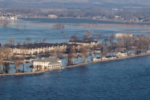
Flooded Camp Ashland, Army National Guard facility, is seen in this aerial photo taken in Ashland, Nebraska, U.S., March 17, 2019. Picture taken March 17, 2019. Courtesy Herschel Talley/Nebraska National Guard/Handout via REUTERS

Flooded Camp Ashland, Army National Guard facility, is seen in this aerial photo taken in Ashland, Nebraska, U.S., March 17, 2019. Picture taken March 17, 2019. Courtesy Herschel Talley/Nebraska National Guard/Handout via REUTERS

The floodwaters forced the operators of the Cooper nuclear plant, near Brownville, Nebraska, to fly in staff and supplies by helicopter, and covered one-third of that state’s Offutt Air Force Base, near Bellevue, home to the U.S. Strategic Command. The nuclear plant continued to operate safely and was at full power, its operator said.

The National Weather Service reported that some of the region’s larger rivers were running at record highs above flood level, causing levy breaks. Some small towns and communities have been cut off by floods while others have seen fresh drinking water become scarce. Floodwaters destroyed many homes and businesses over the weekend.

The NWS reported that temperatures across the hardest-hit areas will reach above 50 degrees Fahrenheit (10 C) through midweek and exceed 60 Fahrenheit by Friday. That would speed the pace of snow melt across the region and contribute water to already swollen rivers, the NWS said, possibly forcing evacuations in communities along the Missouri River on the Nebraska and Iowa border, as well as along the Elkhorn and Platte rivers in Nebraska.

“There could be issues across portions of Nebraska and Kansas for the next seven days,” NWS meteorologist Jim Hayes said.

Nebraska Governor Pete Ricketts, who declared a statewide emergency last week, said on Monday that emergency officials have rescued about 300 people but that at least one person was missing.

At Offutt Air Force Base, 30 buildings had been flooded by up to 8 feet (2.4 m) of water and 30 more structures had been damaged, according to reports by the Omaha World-Herald, citing a base spokeswoman. Base officials did not immediately respond to a request for comment.

The flooding covered 3,000 feet of the base’s 11,700-foot runway, the World-Herald reported.

The weather was blamed for three deaths, including one person who died at home after failing to evacuate, and a man swept away while trying to tow a trapped car with his tractor.

In Iowa, one man died after he was submerged in floodwaters on Friday in Riverton, according to the Fremont County Sheriff’s Office.

Iowa Governor Kim Reynolds also issued an emergency proclamation at the outset of the flooding.

(Reporting by Gina Cherelus in New York and Rich McKay in Atlanta; Editing by Scott Malone)

‘Bomb cyclone’ pushes east across U.S. after winter siege of Midwest, Rockies

A general view of the blizzard in Greeley, Colorado, U.S. March 13, 2019 in this picture obtained from social media. Mandatory credit TWITTER @PHOTOWILLG/via REUTERS

(Reuters) – A powerful, late-winter “bomb cyclone” storm pushed east into the U.S. Midwest and the Great Lakes region on Friday after bombarding the Rocky Mountain and Plains states with blizzards, floods and tornados, prompting precautions at a Nebraska nuclear power plant.

In Iowa, a disaster proclamation by Governor Kim Reynolds, issued after reports of flooding, remained in effect overnight.

Nebraska Governor Pete Ricketts also issued an emergency declaration after rain-swollen rivers and dam breaches left many bridges and roads impassable and prompted thousands of residents of the farm state to evacuate.

“Widespread and extremely dangerous flooding will continue today and tonight,” the National Weather Service office in Omaha, Nebraska, said on Friday in a statement.

Many streams will see moderate to major flooding through the weekend, the service added, and flooding along the Missouri River will continue into next week.

The Nebraska Public Power District declared an “unusual event” at its Cooper Nuclear Station power plant on Friday due to the possibility of flooding along the Missouri.

Workers filled sandbags along the river levee and procured other materials for flood protection, the power agency said. It said the plant continued to operate safely and there was no threat to plant employees or to the public.

Thirteen tornados were reported on Thursday in Kentucky, Indiana and Michigan, said Bob Oravec, a meteorologist with the National Weather Service’s Weather Prediction Center in College Park, Maryland, but there were no immediate reports of serious damage.

Meteorologists referred to the storm as a “bomb cyclone,” a winter hurricane that forms when the barometric pressure drops 24 millibars in 24 hours.

At the storm’s peak, 2 feet of snow was dumped on Colorado’s mountain regions, forcing the cancellation of more than 1,300 flights in Denver and trapping more than 1,000 motorists on roadsides. Many had to be rescued by police, who used school buses to ferry them to safety.

There were no remaining blizzard warnings Friday, Oravec said.

“There’s still a good threat of thunderstorms in Louisiana, Mississippi and up into the Great Lakes region as the system pushes into Canada, but it’s not like it was,” he said.

Most power outages were cleared by early Friday, according to the tracking site PowerOutage.US, and air traffic returned to normal at Denver International Airport, a regional hub that was hardest hit by the storm.

(Reporting by Rich McKay; Additional reporting by Keith Coffman, Dan Whitcomb and Scott DiSavino; Editing by Mark Potter and Jonathan Oatis)

Nebraska preps nuclear plant for possible flooding, no public danger

Corp of Engineers photo of the nuclear power plant during the 2011 Missouri River flooding

(Reuters) – Nebraska Public Power District (NPPD) on Friday declared an “unusual event” at its Cooper nuclear power station in Nebraska due to the possibility of flooding along the Missouri River following a powerful winter storm this week.

The plant continues to operate safely and “there is no threat to plant employees or to the public,” the utility said in a release.

The late winter storm, dubbed a “bomb cyclone” by meteorologists, left blizzards, floods and tornados in its wake after hitting the U.S. Mountain and Plains states this week, before pushing east into the Midwest and the Great Lakes Region early Friday.

NPPD said its workers have filled sandbags along the river levee and procured other materials and supplies for flood protection.

The biggest danger to a nuclear plant from flooding is the loss of power, which can make it difficult to cool the uranium fuel in the reactor core and the fuel stored in the spent fuel pool.

That is what caused the fuel in some reactor cores at the Fukushima Daiichi plant in Japan to partially melt down in 2011 after a giant earthquake and tsunami cut power to the plant.

Since Fukushima, all U.S. reactors have been upgraded with additional safety equipment, including portable pumps and generators to keep cooling water circulating through the reactor in case the plant loses offsite power.

NPPD said its procedures require it to declare an unusual event to the U.S. Nuclear Regulatory Commission when the Missouri River tops 899 feet above sea level. It reached 899.05 feet Friday morning, the company said.

Should the river rise to 900 feet above sea level, NPPD said plant workers will “barricade internal doorways as another layer of protection for facility equipment.”

If the river reaches 901.5 feet above sea level, NPPD said it would take the station offline as a protective measure.

The plant was built at 903 feet above sea level, which is 13 feet above natural grade, NPPD said.

The Cooper station is three miles (4.8 km) southeast of Brownville, Nebraska, near the Missouri River.

(Reporting by Scott DiSavino; Editing by David Gregorio and Richard Chang)

Monster mudslides, water rescues as storm punishes California

A man carries flowers in the rain in the flower district on Valentine's Day in Los Angeles, California, U.S., February 14, 2019. REUTERS/Lucy Nicholson

By Andrew Hay

(Reuters) – Motorists swam for their lives and residents were rescued from homes sliding downhill as the wettest winter storm of the year triggered floods and mudslides across California on Thursday.

In Sausalito, just across the Golden Gate Bridge from San Francisco, a mudslide carried away two homes and engulfed five cars, sending one woman to the hospital, Southern Marin Fire Department tweeted. Dozens of homes were evacuated in the area.

In Cabazon, about 84 miles (135 km) east of Los Angeles, two motorists swam from their vehicle and were rescued by helicopter after their car was engulfed by churning brown floodwaters, a California Department of Forestry and Fire Protection spokesman said.

“We’ve had multiple water rescues throughout the day, I think today our helicopter is up to about a dozen,” said CalFire spokesman Richard Cordova. “We haven’t seen rain like this in 10 years.”

Three Delta Air Lines passengers suffered minor injuries when severe turbulence shook a flight headed from southern California to Seattle on Wednesday, according to authorities.

The moisture-rich tropical storm, known as an atmospheric river, has lashed Northern California with rain and snow since late Tuesday. The moisture flow, nicknamed the “Pineapple Express” for its origin near Hawaii, unleashed its full force overnight.

Power lines, trees and car-sized boulders littered roads in San Diego County and flash flood warnings were in place after regions like Palomar Mountain got nearly 10 inches (25 cm) of rain, according to the National Weather Service (NWS).

WILDFIRE AREAS AT RISK

To the north, Venado, a town near San Francisco famed for its rainfall, got more than one foot of precipitation over 48 hours.

Areas, particularly at risk, were those that suffered deadly wildfires in the last two years, leaving scorched hillsides devoid of vegetation and prone to collapse.

Residents in Northern California’s Butte County – where the Camp fire killed 86 people and destroyed nearly 19,000 structures last year – were told to leave their homes over concerns a creek could overflow and flood communities.

Hundreds of people in Lake Elsinore, 56 miles east of Los Angeles, got mandatory evacuation orders on fears hillsides scorched by the 2018 Holy Fire could turn into debris flows.

To the north Redding, the town devastated by the Carr Fire in 2018, was hit with around 14 inches of snow that shut down Interstate 5 south of the Oregon border and knocked out power to thousands of customers.

A couple more feet of snow was expected to fall in the Sierra Nevada Mountains of northern California through Friday, said NWS meteorologist Hannah Chandler-Cooley in Sacramento.

(Reporting by Rich McKay; Additional reporting by Andrew Hay and Tracy Rucinski; Editing by David Gregorio and Tom Brown)

‘Once-in-100-year’ storm triggers Sydney chaos as heat fans Queensland fires

A flooded street in Sydney, New South Wales, Australia November 28, 2018, in this still image taken from a video obtained from social media. @DeeCee451/via REUTERS

By Colin Packham

SYDNEY (Reuters) – Torrential rain and gale force winds lashed Australia’s biggest city of Sydney on Wednesday causing commuter chaos, flooding streets, railway stations and homes, grounding flights and leaving hundreds of people without electricity.

Police called on motorists to stay off the roads. One person was killed in a car crash and two police seriously injured when a tree fell on them as they helped a stranded driver.

Greg Transell, an office manager in Sydney’s north, told the Australian Broadcasting Corporation that strong winds caused widespread disruption to the tower block office where he works.

“I started to go upstairs to see if there was any damage and next minute there was an almighty bang and it ripped panels off the roof in the warehouse,” said Transell.

Australia’s Bureau of Meteorology (BOM) Sydney got more than 100 mm of rain in just a few hours, a level that the country’s most populous city would normally get through the whole of November.

“That’s the sort of rainfall you’d expect to see once every 100 years,” said Ann Farrell, the bureau’s state manager, told reporters.

The rain offered a welcomed respite to farmers who have suffered through a sustained drought in recent months, but it caused major disruptions to transport.

A Qantas plane takes off during heavy rains in Sydney, New South Wales, Australia November 28, 2018 in this still image taken from a video obtained from social media. Adem Yaglipnar/via REUTERS

A Qantas plane takes off during heavy rains in Sydney, New South Wales, Australia November 28, 2018 in this still image taken from a video obtained from social media. Adem Yaglipnar/via REUTERS

Sydney airport, the country’s busiest, said 130 flights had been canceled or delayed after it was forced to close two of its three runways.

“The storm is pretty intense in and around the airport,” Cait Kyann, an airport spokeswoman, told Reuters.

“We are operating from a single runway so that means that there are delays and likely some flights will be canceled.”

Ausgrid, the nation’s biggest electricity network, said the storm had cut power to 8,100 customers in Sydney and the Central Coast area to its north.

By late afternoon, 1,700 homes and businesses remained without power, Ausgrid said.

The storm struck only hours before the main morning peak hour, transforming some streets into fast-flowing rivers and parks into lakes. Several stranded motorists were plucked from rising floodwaters.

Vehicles drive on a flooded street in Sydney, New South Wales, Australia November 28, 2018 in this still image taken from a video obtained from social media. @DeeCee451/via REUTERS

Vehicles drive on a flooded street in Sydney, New South Wales, Australia November 28, 2018 in this still image taken from a video obtained from social media. @DeeCee451/via REUTERS

“We are asking all road users to reconsider the need to be on the roads throughout what will be a severe rain event,” said New South Wales state Assistant Police Commissioner Michael Corboy.

In contrast, in Australia’s northern state of Queensland, soaring temperatures near 40 degrees Celsius (104 Fahrenheit) and strong winds exacerbated major bushfires.

Firefighters have been battling for nearly a week to contain more than 130 fires across Queensland, and 8,000 people were ordered to evacuate the city of Gracemere, about 600 km (370 miles) north of the state capital, Brisbane.

“These are unprecedented conditions,” said state premier Annastacia Palaszczuk. “We have not seen the likes of this.”

(Reporting by Colin Packham; additional reporting by Paulina Duran and Byron Kaye; Editing by Michael Perry and Nick Macfie)

Former Hurricane Michael heads northeast after trashing Florida

Waves crash on stilt houses along the shore due to Hurricane Michael at Alligator Point in Franklin County, Florida, U.S., October 10, 2018. REUTERS/Steve Nesius

By Rod Nickel

PANAMA CITY, Fla. (Reuters) – Tropical Storm Michael took its drenching rains to Georgia and the Carolinas on Thursday after battering Florida’s Panhandle as the third most powerful hurricane ever to strike the U.S. mainland and killing at least two people.

Michael shattered houses and buildings, downed power lines and ripped up trees when it crashed ashore on Wednesday afternoon, carrying winds of up to 155 miles per hour (250 kilometers per hour) and causing deep seawater flooding.

Emergency crews work to clear a street of debris during Hurricane Michael in Panama City Beach, Florida, U.S. October 10, 2018. REUTERS/Jonathan Bachman

Emergency crews work to clear a street of debris during Hurricane Michael in Panama City Beach, Florida, U.S. October 10, 2018. REUTERS/Jonathan Bachman

Residents and officials were taking stock of the damage on Thursday.

“I think everything from Panama City down to Mexico Beach is way worse than anybody ever anticipated,” Florida Governor Rick Scott told the Weather Channel. Michael’s eye came ashore near Mexico Beach, about 20 miles (32 km) southeast of Panama City.

“This is going to be a long recovery but Florida is resilient, we help each other, and we survive,” Scott said. “We worked all night in endangered circumstances.”

It was not yet known what had happened to about 280 residents of Mexico Beach who authorities said had ignored evacuation orders as the storm approached the state’s northwest. The area is known for its small beach towns, wildlife reserves and the state capital, Tallahassee.

Michael was a Category 4 storm on the five-step Saffir-Simpson hurricane intensity scale, just shy of a rare Category 5, when it came ashore. It weakened steadily as it traveled inland over the Panhandle.

By 8 a.m. EDT (1200 GMT) Thursday it had been downgraded to a tropical storm with 50-mph (85-kph) winds as it pushed through Georgia into the Carolinas, the National Hurricane Center said.

Parts of North Carolina and Virginia could get as much as 9 inches (23 cm) of rain and life-threatening flash floods, the NHC said. The Carolinas are still recovering from Hurricane Florence last month.

The two people killed in the storm were a man who died when a tree toppled onto his house in Florida and a girl who died when debris fell into a home in Georgia, officials and local media said.

More than 830,000 homes and businesses were without power in Florida, Alabama and Georgia early Thursday.

A McDonald's sign damaged by Hurricane Michael is pictured in Panama City Beach, Florida, U.S. October 10, 2018. REUTERS/Jonathan Bachman

A McDonald’s sign damaged by Hurricane Michael is pictured in Panama City Beach, Florida, U.S. October 10, 2018. REUTERS/Jonathan Bachman

‘SURREAL’ WIND

The hurricane, the fiercest to hit Florida in 80 years, pummeled communities across the Panhandle and turned streets into roof-high waterways.

“The wind that came through here was surreal. It destroyed everything,” Jason Gunderson, a member of a group of rescue workers that calls itself the Cajun Navy, told CNN early on Thursday from Callaway, a suburb of Panama City.

“It’s unlivable. It’s heartbreaking.”

Thousands of people hunkered down in shelters overnight after fleeing their homes ahead of the storm.

An estimated 6,000 people evacuated to emergency shelters, mostly in Florida, and that number was expected to swell to 20,000 across five states by week’s end, said Brad Kieserman of the American Red Cross.

Twenty miles (32 km) south of Mexico Beach, floodwaters were more than 7 feet (2.1 meters) deep near Apalachicola, a town of about 2,300 residents, hurricane center chief Ken Graham said. Wind damage was also evident.

“There are so many downed power lines and trees that it’s almost impossible to get through the city,” Apalachicola Mayor Van Johnson said.

Michael had rapidly intensified as it churned north over the Gulf of Mexico in recent days, growing from a tropical storm into a Category 4 hurricane in about 40 hours and catching many by surprise.

With a low barometric pressure recorded at 919 millibars, the measure of a hurricane’s force, it ranked as the third strongest storm on record to make landfall in the continental United States. Only Hurricane Camille on the Mississippi Gulf Coast in 1969 and the so-called Labor Day hurricane of 1935 in the Florida Keys were more intense.

U.S. President Donald Trump declared a state of emergency for all of Florida, freeing federal assistance to supplement state and local disaster responses.

About 3,500 Florida National Guard troops were deployed, along with more than 1,000 search-and-rescue personnel, Governor Scott said.

Even before landfall, the hurricane disrupted energy operations in the Gulf, cutting crude oil production by more than 40 percent and natural gas output by nearly one-third as offshore platforms were evacuated before the storm hit.

(Reporting by Rod Nickel in Panama City, Florida; Additional reporting by Devika Krishna Kumar in Tallahassee, Florida; Susan Heavey, Steve Holland and Roberta Rampton in Washington; Gina Cherelus and Barbara Goldberg in New York; Dan Whitcomb in Los Angeles; Brendan O’Brien in Milwaukee, Liz Hampton in Houston, Andrew Hay in New Mexico; Writing by Steve Gorman and Bill Trott; Editing by Jeffrey Benkoe and Frances Kerry)

Death toll from Nigeria floods reaches 199

FILE PHOTO: A man makes his way through flood waters in Kogi State, Nigeria September 17, 2018. REUTERS/Afolabi Sotunde/File Photo

ABUJA (Reuters) – The death toll from floods across much of central and southern Nigeria has reached 199, the national disaster agency said on Wednesday, almost doubling the number of people killed from three weeks earlier.

The almost annual floods, exacerbated by poor infrastructure and lack of planning to protect against inundation, are the worst since 2012, when at least 363 people died.

FILE PHOTO: A house partially submerged in flood waters is pictured in Lokoja city, Kogi State, Nigeria September 17, 2018. REUTERS/Afolabi Sotunde/File Photo

FILE PHOTO: A house partially submerged in flood waters is pictured in Lokoja city, Kogi State, Nigeria September 17, 2018. REUTERS/Afolabi Sotunde/File Photo

This year floods have hit one-third of Nigeria’s 36 states since late August, affecting 1.92 million people and displacing over 560,000 of them, said the National Emergency Management Agency (NEMA).

Nigeria’s rainy season is now drawing to a close, but flood waters could take time to recede, while humanitarian needs are pressing and diseases such as cholera are a major risk, said the agency.

Flooding in recent years has left hundreds of thousands of people homeless in Nigeria, Africa’s biggest energy producer and most populous country.

(Reporting by Paul Carsten; Editing by Richard Balmforth)

En route to Florida, ‘monster’ Hurricane Michael strengthens

Hurricane Michael in a satellite image taken Tuesday. NOAA/via REUTERS

By Devika Krishna Kumar

TALLAHASSEE, Fla. (Reuters) – U.S. authorities ordered tens of thousands of people to heed warnings of life-threatening coastal floods, wind and rain and get out of harm’s way as Hurricane Michael churned over the Gulf of Mexico toward the Florida Panhandle on Tuesday.

Residents and tourists were told to evacuate coastal areas in at least 20 counties in Florida. The Category 2 storm, which has already disrupted oil production in the Gulf of Mexico, strengthened as it headed north, carrying winds of 110 miles per hour (175 km per hour).

It was forecast to become a Category 3 storm on the five-step Saffir-Simpson scale before coming ashore on Wednesday over the Florida Panhandle or the Big Bend area in the northwest of the state, the National Hurricane Center (NHC) said. At that strength, it would rank as the most powerful storm to strike the Panhandle in more than a decade.

“Hurricane Michael is a monster storm and it keeps getting more dangerous,” Florida Governor Rick Scott told a news conference on Tuesday. “The time to prepare is now.”

The Republican governor, who is campaigning for a U.S. Senate seat in the November congressional elections, warned of the potential for a deadly storm surge that could be as much as 12 feet (3.7 meters) over normal sea water levels.

People in areas that could be affected should take no chances against such a powerful surge, Scott said, adding, “No one’s going to survive,” such a wall of water.

As Michael moved over open water, energy companies halted nearly one-fifth of Gulf of Mexico oil production and evacuated personnel from 10 platforms on Monday.

The Gulf of Mexico produces 17 percent of daily U.S. crude oil output and 5 percent of daily natural gas output, according to the U.S. Energy Information Administration. The partial shutdown ahead of Michael helped push oil prices slightly higher on Tuesday.

Scott declared a state of emergency in 35 counties along the Panhandle and Florida’s Big Bend regions, mostly rural areas known for small tourist cities, beaches and wildlife reserves, as well as the state capital, Tallahassee.

A hurricane warning was in effect for a more than 300-mile (480-km) stretch of coastline from the Florida-Alabama border to the Suwannee River in Florida.

The Federal Emergency Management Agency had numerous teams deployed and ready to respond, said FEMA spokesman Jeff Byard. About 1,250 National Guard soldiers were assisting and more than 4,000 troops were on standby.

President Donald Trump, speaking to reporters at the White House, said the country was very well prepared for the hurricane, adding it was much bigger than had been expected.

Alexander Charnicharo fishes at the seafront in Havana as Hurricane Michael passes by western Cuba on October 8, 2018. REUTERS/Alexandre Meneghini

Alexander Charnicharo fishes at the seafront in Havana as Hurricane Michael passes by western Cuba on October 8, 2018. REUTERS/Alexandre Meneghini

CLOSURES AND LINES FOR GAS

State offices, schools and universities were closed through the end of the week in Panhandle counties. Lines at gasoline stations grew as people left. Those who stayed emptied grocery store shelves of water and other supplies.

Regus, an international office provider, offered temporary space for rent in Birmingham, Alabama, for businesses evacuating neighboring Florida.

“If you’re evacuating #HurricaneMichael and need a place to work, come visit a business lounge at any of our 5 locations in Birmingham! #evacuate #HurricanePrep #Michael,” the company wrote on Twitter.

The last major hurricane – Category 3 or above – to hit the Panhandle was Hurricane Dennis, which made landfall near Pensacola in 2005, according to hurricane center data.

Torrential downpours and flash flooding caused by the storm over the weekend caused 13 deaths in Central America.

At 11 a.m. ET (1500 GMT) on Tuesday, Michael’s center was about 335 miles (535 km) south-southwest of Apalachicola, Florida, heading north at around 12 mph (19 kph), the NHC said.

On its current track, it would make landfall somewhere along a coastline that includes the cities and towns of Fort Walton Beach, Panama City Beach, Port St. Joe, St. Teresa and the wildlife reserves bordering Apalachee Bay. However, forecasters always note it is not possible to predict where a hurricane will land until it is closer to the coast.

The storm was forecast to move through the southeastern United States on Wednesday and Thursday, passing through the Carolinas, which are still recovering from Hurricane Florence last month. It would head off the Mid-Atlantic coast by Friday, the NHC said.

The Miami-based center forecast as much as 1 foot (30 cm) of rain in parts of Florida, Georgia and South Carolina.

(Reporting by Devika Krishna Kumar; Additional reporting by Susan Heavey and Roberta Rampton in Washington, Gina Cherelus and Barbara Goldberg in New York, Brendan O’Brien in Milwaukee; Editing by Lisa Shumaker and Frances Kerry)

Japan braces as typhoon charts course for main island

Super typhoon Trami is seen from the International Space Station as it moves in the direction of Japan, September 25, 2018 in this image obtained from social media on September 26, 2018. ESA/NASA-A.Gerst/via REUTERS

By Elaine Lies

TOKYO (Reuters) – Japan braced for high winds and heavy rain as a typhoon roared north on Friday, enveloping outlying islands in high seas before taking aim at the rest of the nation and raking across its biggest main island at the weekend.

Typhoon Trami, rated category 2 by Tropical Storm Risk, with category 5 the highest, is the latest storm to threaten Japan in a year filled with more than the usual number of disasters, including punishing heat, heavy rains, and landslides.

Less than a month ago, a typhoon flooded Kansai International airport near Osaka, leaving thousands of tourists stranded.

Outlying islands in the Okinawan chain, some 1,000 km southwest of Tokyo, were being pounded by heavy seas and strong winds, just two days before an Okinawan gubernatorial election, forcing some areas to hold voting early. The central government set up an emergency office to deal with the storm.

Trami was about 300 km (186 miles) southeast of Miyako island, with winds gusting as high as 216 kilometers an hour (134 mph).

Churning north across Okinawa on Saturday, Trami is then predicted to rake across the islands of Kyushu and the main island of Honshu on Sunday, a path similar to that taken by typhoon Jebi early in September.

Though the Japanese capital of Tokyo is set for heavy rain, current predictions show it avoiding a direct hit.

Jebi, the most powerful storm to hit Japan in 25 years, brought some of the highest tides since a 1961 typhoon and flooded Kansai airport near Osaka, taking it out of service for days.

Seventeen people died in the storm, whose high winds sent trees crashing to the ground and cars scudding across parking lots.

Even for a nation accustomed to disasters, this year has been hard for Japan, starting with a volcanic eruption in January that rained rocks down on a ski resort, killing one.

July brought record-breaking heat that killed at least 80 people and sent over 20,000 to the hospital for treatment, along with torrential rains in western Japan that set off floods and landslides, killing more than 200.

Just two days after Jebi hit in September, the northernmost main island of Hokkaido was rocked by an earthquake that set off landslides, knocked out power throughout the island and killed at least 44 people.

(Editing by Nick Macfie)

Flooding expected to worsen in Carolinas after Florence’s departure

Emergency personnel and local media drive through flooded streets to assess the damage caused by Hurricane Florence, in Spring Lake, North Carolina, September 17, 2018. Spc. Austin T. Boucher/U.S. Army/Handout via REUTERS

By Anna Mehler Paperny

KINSTON, N.C. (Reuters) – Flooding from rain-swollen rivers was expected to worsen across the Carolinas on Thursday and the next couple of days in the aftermath of Hurricane Florence, which killed 36 people in three states, forecasters said.

Twenty flood gauges showed some level of flooding in North Carolina, South Carolina and Virginia, where some major waterways, well above their flood stages, were expected to rise through the weekend before they crest, the National Weather Service said.

“People in flood prone areas or near waterways need to remain alert as rivers crest and stay above their banks in coming days,” North Carolina Governor Roy Cooper said in a written statement. “Stay alert and stay safe.”

Touring the area on Wednesday, U.S. President Donald Trump warned South Carolina that “water is coming your way.”

“Now it looks nice but it’s really the calm before the storm,” he said.

Florence dumped up to 36 inches (91 cm) of rain on parts of North Carolina and many areas remained cut off by floodwaters and inundated roads. The slow-moving storm made landfall on Friday as a Category 1 hurricane.

In Lenoir County, North Carolina, where the rising Neuse River has flooded some roads, emergency medical workers have been running a “mobile disaster hospital,” which provides urgent care to residents cut off from the nearest hospital.

Tripp Winslow, medical director of North Carolina Emergency Medical Services, helped set up the mobile emergency room during a downpour on Saturday night. They have received 20 to 30 patients a day so far, he said, but expect to be busier as the river crests.

“Once we get isolated we expect to see more,” he said. “No pun intended, it’s a fluid situation.”

Members of the National Guard work on a long sand bag flood barrier being built by the South Carolina Department of Transportation on U.S. 501 to lesson damage to roads anticipated from floods caused by Hurricane Florence, now downgraded to a tropical depression, in Conway, South Carolina, U.S. September 19, 2018. REUTERS/Randall Hill

Members of the National Guard work on a long sand bag flood barrier being built by the South Carolina Department of Transportation on U.S. 501 to lesson damage to roads anticipated from floods caused by Hurricane Florence, now downgraded to a tropical depression, in Conway, South Carolina, U.S. September 19, 2018. REUTERS/Randall Hill

MANY STILL WITHOUT POWER

At least 36 deaths have been attributed to the storm, including 27 in North Carolina, eight in South Carolina and one in Virginia.

Some 2,600 people had been rescued by boat or helicopter in North Carolina alone since the storm made landfall, and about 10,000 people remain in shelters, according to state officials.

More than 121,000 customers were without power across North Carolina, and more than 2.1 million customers across the southeast United States were affected by the storm, according to utilities.

Duke Energy Corp started to return its Brunswick nuclear power plant in North Carolina to service on Thursday. The company shut both reactors at the 1,870-megawatt facility before Florence hit the coast near the plant in Southport, about 30 miles (48 km) south of Wilmington.

One megawatt can power about 1,000 U.S. homes.

As floodwaters continue to rise, concerns are growing about the environmental and health dangers lurking in the water.

The flooding has caused 21 hog “lagoons,” which store manure from pig farms, to overflow, creating a risk that standing water will be contaminated, according to the state’s Department of Environmental Quality. North Carolina is one of the leading hog-producing states in the country.

Several sewer systems in the region also have released untreated or partly treated sewage and storm water into waterways over the last week, local media reported.

Experts have said that climate change has increased the likelihood of more massive, sluggish storms like Florence, capable of dropping record amounts of rain and touching off catastrophic flooding.

(Reporting by Anna Mehler Paperny in Kinston, North Carolina; Additional reporting by Jeff Mason in Conway, South Carolina, Brendan O’Brien in Milwaukee, and Scott DiSavino in New York; Writing by Joseph Ax; Editing by Larry King and Bill Trott)