Migrant deaths rise among Venezuelans, Central Americans: U.N.

FILE PHOTO: The U.S.-Mexico border is seen near Lukeville, Pima County, Arizona, U.S., September 11, 2018. REUTERS/Lucy Nicholson/File Photo

By Stephanie Nebehay

GENEVA (Reuters) – At least 380 Latin American migrants have died on their journeys this year, many of them Venezuelans drowning in the Caribbean or Central Americans perishing while trying to cross the U.S.-Mexico border, the U.N. migration agency said on Tuesday.

The toll, 50 percent more than the 241 recorded as of mid-June 2018, also coincides with tightened security along the U.S. southern border, which often leads migrants to turn to underground criminal smugglers and take riskier routes, it said.

President Donald Trump has made reducing illegal migration one of his signature policy pledges. His administration on Monday cut hundreds of millions of dollars in aid to El Salvador, Guatemala and Honduras, after Trump blasted the three Central American countries because thousands of their citizens had sought asylum at the U.S. border with Mexico.

“This month has been marked by several tragedies on the U.S.-Mexico border, where at least 23 people have died since May 30 May, that is more than one per day,” spokesman Joel Millman of the International Organization for Migration told a briefing.

IOM figures show that so far, 144 migrants are known to have died in Mexico, 143 in the Caribbean, 66 along Mexico’s southern border with Central America and 27 in South America.

A further 42 reported deaths were under investigation in Mexico, and of several dozen more refugees and migrants crossing the Darien jungle in Panama, he added.

“So we are seeing a level of fatality that we haven’t seen before. We caution that with the summer months just beginning, with the intense heat that brings, we can expect it to get worse,” Millman said.

Four million Venezuelans have fled their homeland, most of them since an economic and humanitarian crisis began in 2015, the U.N. refugee agency says. Most went overland to Colombia, Peru, Ecuador and Brazil.

But in images reminiscent of desperate Cubans fleeing their homeland in decades past, Venezuelans increasingly are taking to the sea in rickety boats.

The overall toll includes more than 80 Venezuelans who have died or disappeared in three shipwrecks in the Caribbean in the past two months, Millman said.

UNHCR spokesman Babar Baloch called for better search and rescue operations to save Venezuelans fleeing via the Caribbean.

“As Venezuelans continue to use dangerous sea routes to leave their country, the U.N. refugee agency is calling for more coordinated search and rescue efforts to prevent further loss of life,” Baloch said.”It is also absolutely vital that people are able to access safe territory in ways that do not require them to risk their lives,” he said.

(Reporting by Stephanie Nebehay; Editing by Mark Heinrich)

Isolation, evacuations in U.S. central Plains as floods kill three

Flooded Camp Ashland, Army National Guard facility, is seen in this aerial photo taken in Ashland, Nebraska, U.S., March 17, 2019. Picture taken March 17, 2019. Courtesy Herschel Talley/Nebraska National Guard/Handout via REUTERS

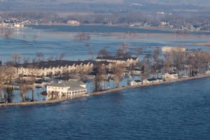
(Reuters) – Flooding that killed three people in the central plains of Nebraska and Iowa has cut roads to a nuclear power plant and inundated a large portion of a U.S. Air Force base, forcing it to work with a skeleton staff on Monday, while more of region’s residents possibly faced evacuation.

The floods, which have prompted each state’s governor to declare a state of emergency, are the result of last week’s “bomb cyclone” winter storm, a winter hurricane that blew in from the western Rocky Mountains. Three people died in the flooding and at least one person was missing after hundreds of weekend rescues.

Flooded Camp Ashland, Army National Guard facility, is seen in this aerial photo taken in Ashland, Nebraska, U.S., March 17, 2019. Picture taken March 17, 2019. Courtesy Herschel Talley/Nebraska National Guard/Handout via REUTERS

Flooded Camp Ashland, Army National Guard facility, is seen in this aerial photo taken in Ashland, Nebraska, U.S., March 17, 2019. Picture taken March 17, 2019. Courtesy Herschel Talley/Nebraska National Guard/Handout via REUTERS

The floodwaters forced the operators of the Cooper nuclear plant, near Brownville, Nebraska, to fly in staff and supplies by helicopter, and covered one-third of that state’s Offutt Air Force Base, near Bellevue, home to the U.S. Strategic Command. The nuclear plant continued to operate safely and was at full power, its operator said.

The National Weather Service reported that some of the region’s larger rivers were running at record highs above flood level, causing levy breaks. Some small towns and communities have been cut off by floods while others have seen fresh drinking water become scarce. Floodwaters destroyed many homes and businesses over the weekend.

The NWS reported that temperatures across the hardest-hit areas will reach above 50 degrees Fahrenheit (10 C) through midweek and exceed 60 Fahrenheit by Friday. That would speed the pace of snow melt across the region and contribute water to already swollen rivers, the NWS said, possibly forcing evacuations in communities along the Missouri River on the Nebraska and Iowa border, as well as along the Elkhorn and Platte rivers in Nebraska.

“There could be issues across portions of Nebraska and Kansas for the next seven days,” NWS meteorologist Jim Hayes said.

Nebraska Governor Pete Ricketts, who declared a statewide emergency last week, said on Monday that emergency officials have rescued about 300 people but that at least one person was missing.

At Offutt Air Force Base, 30 buildings had been flooded by up to 8 feet (2.4 m) of water and 30 more structures had been damaged, according to reports by the Omaha World-Herald, citing a base spokeswoman. Base officials did not immediately respond to a request for comment.

The flooding covered 3,000 feet of the base’s 11,700-foot runway, the World-Herald reported.

The weather was blamed for three deaths, including one person who died at home after failing to evacuate, and a man swept away while trying to tow a trapped car with his tractor.

In Iowa, one man died after he was submerged in floodwaters on Friday in Riverton, according to the Fremont County Sheriff’s Office.

Iowa Governor Kim Reynolds also issued an emergency proclamation at the outset of the flooding.

(Reporting by Gina Cherelus in New York and Rich McKay in Atlanta; Editing by Scott Malone)

Parts of ravaged Paradise open for first time since California wildfire

FILE PHOTO: Deer are seen on a property damaged by the Camp Fire in Paradise, California, U.S. November 21, 2018. REUTERS/Elijah Nouvelage/File Photo

By Saif Tawfeeq

PARADISE, Calif. (Reuters) – Thousands of Paradise residents who fled a monster blaze a month ago were allowed on Wednesday to return to some neighborhoods in the Northern California city nearly obliterated by one of the deadliest wildfires in U.S. history.

Tim Moniz, a rice farmer, and welder in his 50s, personally surveyed the remains of his Paradise property for the first time since the fire, confirming his suspicions that his house was gone. He and his wife only recently paid off the mortgage.

“It seems unfair that some houses make it and yours don’t,” Moniz said. “I just had to get back up and see it and try to salvage something.”

Paradise residents who return to their ravaged homes will face a daunting task to resume normal life, with some likely to encounter months or even years of work to obtain compensation for their losses and rebuild.

Authorities hurriedly evacuated some 50,000 people in Paradise and neighboring towns when the Camp Fire erupted on Nov. 8. The fire killed at least 85 people with nearly a dozen still unaccounted for. It also destroyed nearly 14,000 homes in the wooded, foothill communities.

Evacuation orders were previously lifted in areas outside Paradise, but Wednesday marked the first day officials opened parts of the city itself in the midst of the fire’s scorched wasteland of 153,000 acres (61,900 hectares).

REBUILDING A RESHAPED TOWN

Moniz said he is among those planning to rebuild, rather than move away.

But the fire’s devastation will reshape the town and – at least initially – lower its population, Paradise Mayor Jody Jones said by telephone.

“All my friends who are in their 80s, they’re just not going to go through this process of rebuilding,” Jones said, adding she believes three-quarters of Paradise residents will rebuild.

Some residents may be able to salvage jewelry or even stuff such as intact tool boxes from the rubble of their houses, said Jones, who lost her own home in the fire.

Some residents rumbled back into town in recreational vehicles, apparently planning to spend the night, Paradise Police Chief Eric Reinbold said by phone.

Authorities said they will let some residents stay overnight on their properties, but advise against it because electricity, gas and other services were not available.

Paradise’s skyline is dotted with 30 large cranes that crews are using to remove debris, said city spokesman Matt Gates.

Health and safety specialists are sweeping through Paradise to remove batteries, propane tanks, household chemicals and other environmental hazards in the aftermath of the fire, Gates said. Residents entering the re-opened areas of town were offered gear to protect themselves from hazardous materials, Reinbold said.

Full removal of debris could take nine months, Jones said.

(Reporting by Saif Tawfeeq; Additional reporting and writing by Alex Dobuzinskis in Los Angeles; editing by Bill Tarrant and Lisa Shumaker)

Five dead in California wildfire as second blaze forces Malibu evacuation

Firefighters battle flames overnight during a wildfire that burned dozens of homes in Thousand Oaks, California, U.S. November 9, 2018. REUTERS/Eric Thayer

By Stephen Lam

PARADISE, Calif. (Reuters) – A rapidly moving wildfire in Northern California killed five people when flames engulfed their vehicles as they attempted to flee the mountain town of Paradise in one of three infernos raging across the state, authorities said on Friday.

Nearly 500 miles (800 km) to the south, a blaze forced the evacuation of the upscale oceanside city of Malibu, home to many celebrities, and threatened the beleaguered town of Thousand Oaks, where a gunman killed 12 people this week in a shooting rampage in a bar and dance hall.

Since it broke out on Thursday, the so-called Camp Fire has more than tripled in size to 70,000 acres (2,838 hectares) after engulfing Paradise, a town of nearly 30,000 people, and was only 5-percent contained by Friday.

“The town is devastated, everything is destroyed,” said California Department of Forestry and Fire Protection (Cal Fire) spokesman Scott Mclean, referring to Paradise, which has a population of 26,000 including many retirees.

In addition to the five people found dead in their vehicles, many were forced to abandon their cars and run for their lives down the sole road through the mountain town. About 2,000 structures were destroyed in the area, officials said.

The death toll is expected to climb above five, Mclean said, because flames have blocked search and rescue crews from looking for victims in destroyed homes.

“The only reason they found the five is because they were still on the road,” Mclean said.

HOT WINDS

The fires in California have been driven by hot winds from the east reaching speeds of up to 40 miles per hour (64 kph), forcing firefighters to scramble to keep up with the fast-moving flames.

In Southern California, the 14,000-acre (5,666-hectare) Woolsey Fire led authorities on Friday morning to expand mandatory evacuation orders to the entire city of Malibu.

Flames completely engulfed large homes in at least one affluent neighborhood.

“Fire is now burning out of control and heading into populated areas of Malibu,” the city said in a statement online. “All residents must evacuate immediately.”

In all, the Woolsey Fire led authorities to issue evacuation orders for 75,000 homes in Los Angeles and Ventura counties.

It was not immediately clear how many homes had been destroyed.

Video shot from a news helicopter showed cars at a standstill on the Pacific Coast Highway in Malibu, about 30 miles (48 km) west of downtown Los Angeles. An unspecified number of homes were destroyed there, according to local media.

MOVIE SET TOWN ABLAZE

The Woolsey Fire broke out on Thursday and quickly jumped the 101 Freeway. On Friday, it climbed across the Santa Monica Mountains toward Malibu.

It also threatened parts of nearby Thousand Oaks in Ventura County northwest of Los Angeles, the site of the shooting massacre earlier this week, stunning a community with a reputation for safety.

Linda Parks, a Ventura County supervisor, whose district covers Thousand Oaks, lamented the timing of the wildfire. “We are still reeling, but we are also very resilient,” she said.

On its path of destruction, the fire destroyed a Western-themed movie and television set in Agoura, north of Malibu, a unit of the National Park Service said on Twitter.

Western Town was created in the 1950s for television shows such as “The Cisco Kid,” and more recently was used for television shows such as “Westworld” and “Weeds,” and was a draw for visitors.

California Acting Governor Gavin Newsom on Friday declared a state of emergency for areas affected by the Woolsey and Hill fires in Ventura and Los Angeles counties.

In Los Angeles, another fire in Griffith Park forced the Los Angeles Zoo to evacuate a number of show birds and some small primates on Friday as flames came within less than 2 miles (3 km) of the facility, zoo officials said in a statement.

“Animals and employees are safe,” the statement said.

(Writing by Alex Dobuzinskis; Additional reporting by Bernie Woodall and Brendan O’Brien; Editing by Bill Tarrant and Sandra Maler)

Hurricane Michael tears Florida towns apart, 6 dead

An American flag flies amongst rubble left in the aftermath of Hurricane Michael in Mexico Beach, Florida, U.S. October 11, 2018. REUTERS/Jonathan Bachman

By Devika Krishna Kumar

MEXICO BEACH, Fla. (Reuters) – Hurricane Michael’s violence was visible on Thursday in shattered Florida coastal towns, where rows of homes were ripped from foundations and roofs were peeled off schools by the near-record-force storm blamed for six deaths.

Michael smashed into Florida’s northwest coast near the small town of Mexico Beach on Wednesday with screeching 155 mile per hour (250 kilometer per hour) winds, pushing a wall of seawater inland.

“The wind was really tearing us apart. It was so scary you’d poo yourself,” said retiree Tom Garcia, 60, who was trapped inside his Mexico Beach home as water poured in to waist height.

He and his partner Cheri Papineau, 50, pushed on their door for an hour in an effort to stop the storm surge bursting in as their four dogs sat on top of a bed floating through their home.

Video shot by CNN from a helicopter showed homes closest to the water in Mexico Beach had lost all but their foundations. A few blocks inland, about half the homes were reduced to piles of wood and siding and those still standing had suffered heavy damage.

Michael, the third most powerful hurricane ever to hit the U.S. mainland, weakened overnight to a tropical storm and pushed northeast on Thursday, bringing drenching rains to Georgia and the Carolinas, which are still recovering from Hurricane Florence last month.

Rubble left in the aftermath of Hurricane Michael is pictured in Mexico Beach, Florida, U.S. October 11, 2018. REUTERS/Jonathan Bachman

Rubble left in the aftermath of Hurricane Michael is pictured in Mexico Beach, Florida, U.S. October 11, 2018. REUTERS/Jonathan Bachman

Michael killed at least six people in Florida, Georgia and North Carolina from falling trees and other hurricane-related incidents, officials and local media said.

The injured in Florida were taken to hospitals in Tallahassee, with some hurt after the storm by breaking tree limbs and falls, said Allison Castillo, director of emergency services at the city’s Capital Regional Medical Center.

Brock Long, head of the Federal Emergency Management Agency, called Mexico Beach, which has a population of about 1,200, “ground zero” for the hurricane damage.

In Panama City, 20 miles (32 km) northwest of Mexico Beach, buildings were crushed and boats were scattered around. Michael left a trail of utility wires on roads, flattened tall pine trees and knocked a steeple from a church.

Al Hancock, 45, who works on a tour boat, survived in Panama City with his wife and dog.

“The roof fell in but we lived through it,” he said.

Nearly 950,000 homes and businesses were without power in Florida, Alabama, the Carolinas and Georgia on Thursday.

DAMAGE ‘WAY WORSE’ THAN EXPECTED

Florida Governor Rick Scott told the Weather Channel the damage from Panama City down to Mexico Beach was “way worse than anybody ever anticipated.”

At Jinks Middle School in Panama City, the storm tore off part of the gym roof and one wall, leaving the wooden floor covered in water. A year ago the school welcomed students and families displaced by Hurricane Maria in Puerto Rico.

Rubble left in the aftermath of Hurricane Michael is pictured in Mexico Beach, Florida, U.S. October 11, 2018. REUTERS/Jonathan Bachman

Rubble left in the aftermath of Hurricane Michael is pictured in Mexico Beach, Florida, U.S. October 11, 2018. REUTERS/Jonathan Bachman

“The kids live nearby. The second floor of some apartments are just gone. Roofs are gone,” Principal Britt Smith told CNN after talking by phone with some of those who did not evacuate.

Michael, a Category 4 storm on the five-step Saffir-Simpson hurricane intensity scale when it came ashore, was causing flash flooding on Thursday in parts of North Carolina and Virginia, where some areas could get as much as 9 inches (23 cm) of rain, the National Hurricane Center (NHC) said.

By 2 p.m. EDT (1600 GMT), the storm had pushed northeast to within 25 miles (40 km) of Greensboro, North Carolina, carrying 50-mph (85-kph) winds, the NHC said.

The number of people in emergency shelters was expected to swell to 20,000 across five states by Friday, said Brad Kieserman of the American Red Cross.

‘ROOF-HIGH’ FLOODING

Michael pummeled communities across the Panhandle and turned streets into roof-high waterways.

Twenty miles (32 km) south of Mexico Beach, floodwaters were more than 7 feet (2.1 meters) deep near Apalachicola, a town of about 2,300 residents, hurricane center chief Ken Graham said. Wind damage was also evident.

“Our biggest thing is the downed lines and the downed trees and now this water main issue,” said Apalachicola Mayor Van Johnson, referring to a burst water main complicating efforts to restore power.

Brad Rippey, a meteorologist for the U.S. Agriculture Department, said Michael had severely damaged cotton, timber, pecan and peanuts, causing estimated liabilities as high as $1.9 billion and affecting up to 3.7 million crop acres (1.5 million hectares).

Michael also disrupted energy operations in the U.S. Gulf of Mexico as it approached land, cutting crude oil production by more than 40 percent and natural gas output by nearly one-third as offshore platforms were evacuated.

With a low barometric pressure recorded at 919 millibars, a measure of a hurricane’s force, Michael was the third strongest storm on record to hit the continental United States, behind only Hurricane Camille on the Mississippi Gulf Coast in 1969 and the Labor Day hurricane of 1935 in the Florida Keys.

(Reporting by Rod Nickel in Panama City, Florida; Additional reporting by Devika Krishna Kumar in Tallahassee, Florida; Gina Cherelus and Scott DiSavino in New York; Alex Dobuzinskis in Los Angeles; Brendan O’Brien in Milwaukee, Gary McWilliams and Liz Hampton in Houston, Andrew Hay in New Mexico and Humeyra Pamuk in Washington; Writing by Bill Trott; Editing by Frances Kerry and Bill Berkrot)

Mother and child plus two others killed as Florence swamps Carolinas

A fallen tree lies atop the crushed roof of a fast food restaurant after the arrival of Hurricane Florence in Wilmington, North Carolina, U.S., September 14, 2018. REUTERS/Jonathan Drake


By Ernest Scheyder

WILMINGTON, N.C. (Reuters) – Hurricane Florence crashed into the Carolinas on Friday, knocking down trees, swamping streets and causing four deaths before slowing to a pace that will lead to a days-long deluge for the region.

The storm’s first casualties, which included a mother and her baby killed when a tree fell on their brick house in Wilmington, North Carolina, were announced about eight hours after Florence came ashore. The child’s father was taken to a hospital.

In Pender County, North Carolina, a woman suffered a heart attack and died because hurricane debris blocking roads prevented paramedics from reaching her. A fourth person was killed in Lenoir County while plugging in a generator, the governor’s office said.

After landfall, Florence slowed to a pace that meant it would plague the area with days of flooding. The hurricane’s storm surge – the wall of water it pushed in from the Atlantic – “overwhelmed” the town of New Bern at the confluence of the Neuse and Trent rivers, North Carolina Governor Roy Cooper said.

“To those in the storm’s path, if you can hear me, please stay sheltered in place,” he said at a news conference in Raleigh, adding that Florence would “continue its violent grind across the state for days.”

Authorities said more than 60 people, including many children and pets, had to be evacuated from a hotel in Jacksonville, North Carolina, after strong winds caused parts of the roof to collapse.

The center of the hurricane’s eye came ashore at about 7:15 a.m. EDT (1115 GMT) near Wrightsville Beach close to Wilmington, North Carolina, with sustained winds of 90 miles per hour (150 kph), the National Hurricane Center (NHC) said.

By mid-afternoon the winds had dropped to 75 mph (120 kph) and the center was moving west at 6 mph (10 kph), the NHC said, and parts of North and South Carolina would get as much as 40 inches of rain (1 meter).

Cooper said Florence was set to cover almost all of North Carolina in several feet of water. As of Friday morning, Atlantic Beach, a town on the state’s Outer Banks barrier islands, already had received 30 inches (76 cm) of rain, the U.S. Geological Service said. Twenty inches (50 cm) were reported by early Friday afternoon in the town of Oriental.

Authorities in New Bern, a town of about 30,000 people that dates to the early 18th century, said more than 100 people had to be saved from floods and that the downtown area was underwater. Calls for help kept coming in as the wind picked up and the tide arrived, said city public information officer Colleen Roberts.

“These are folks who decided to stay and ride out the storm for whatever reason, despite having a mandatory evacuation,” she said. “These are folks who are maybe in one-story buildings and they’re seeing the floodwaters rise.”

Video reports from several towns in the Carolinas showed emergency personnel wading through rippling thigh-high floodwaters in residential neighborhoods.

President Donald Trump is expected to travel to areas hit by Florence next week, once it is determined his travel will not disrupt any rescue or recovery efforts, the White House said on Friday.

‘IT’S INSANE’

Florence also blew down trees, including one that went through the roof of Kevin DiLoreto’s home in Wilmington. He said all roads leading to his neighborhood were blocked by fallen trees.

“It’s insane,” he said in a phone interview. “Everybody laughs at the fact that this storm got downgraded … but I’ve never seen tree devastation this bad.

“Afterwards, I’m going to drink a bottle of whiskey and take a two-day nap, but right now I’m walking the neighborhood and making sure my neighbors are fine, because nobody can get in here.”

More than 722,000 homes and businesses were without power in North and South Carolina early on Friday, utility officials said. Utility companies said millions were expected to lose power and restoration could take weeks.

Florence had been a Category 3 hurricane with 120 mph winds on Thursday but dropped to Category 1 before coming ashore. It is expected to move across parts of southeastern North Carolina and eastern South Carolina on Friday and Saturday, then head north over the western Carolinas and central Appalachian Mountains early next week, the NHC said. Significant weakening is expected over the weekend.

About 10 million people could be affected by the storm and more than 1 million were ordered to evacuate the coasts of the Carolinas and Virginia. Some of those who stayed went to shelters while others stuck it out in their homes.

Maysie Baumgardner, 7, and her family sheltered at the Hotel Ballast in downtown Wilmington as Florence filled the streets with floodwaters.

“It looks heavy outside,” she said. “I’m a little bit scared right now, but I have my iPad and I’m watching Netflix.”

Florence was one of two major storms on Friday. In the Philippines, evacuations were under way with Super Typhoon Mangkhut expected to hit on Saturday in an area impacting an estimated 5.2 million people.

(Additional reporting by Gene Cherry in Raleigh; Scott DiSavino and Gina Cherelus in New York; Makini Brice in Washington; Andy Sullivan in Columbia, South Carolina; and Brendan O’Brien in Milwaukee; Writing by Bill Trott; Editing by Bernadette Baum and Nick Zieminski)

Powerful quake paralyzes Hokkaido in latest disaster to hit Japan

Police officers and rescue workers search for survivors from a building damaged by a landslide caused by a powerful earthquake in Atsuma town in Japan's northern island of Hokkaido, Japan, in this photo taken by Kyodo September 6, 2018. Mandatory credit Kyodo/via REUTERS ATTENTION EDITORS - THIS IMAGE WAS PROVIDED BY A THIRD PARTY. MANDATORY CREDIT. JAPAN OUT. NO COMMERCIAL OR EDITORIAL SALES IN JAPAN.

By Kaori Kaneko and Chang-Ran Kim

TOKYO (Reuters) – A powerful earthquake paralyzed Japan’s northern island of Hokkaido on Thursday, killing at least seven people, triggering landslides and knocking out power to its 5.3 million residents.

The death toll from the 6.7-magnitude, pre-dawn quake was likely to rise as rescuers searched houses buried by landslides.

About 33 people were missing and 300 were injured, public broadcaster NHK said. Four people were in cardiopulmonary arrest, a term used before death is officially confirmed.

The quake was the latest in a string of natural disasters to batter Japan after typhoons, flooding, and a record-breaking heat wave within the past two months.

Aerial footage showed dozens of landslides exposing barren hillsides near the town of Atsuma in southern Hokkaido, with mounds of red earth and toppled trees piled at the edge of green fields.

The collapsed remains of what appeared to be houses or barns were strewn about.

A building damaged by a powerful earthquake is seen in Abira town in Japan's northern island of Hokkaido, Japan, in this photo taken by Kyodo September 6, 2018. Mandatory credit Kyodo/via REUTERS

A building damaged by a powerful earthquake is seen in Abira town in Japan’s northern island of Hokkaido, Japan, in this photo taken by Kyodo September 6, 2018. Mandatory credit Kyodo/via REUTERS

“It came in four big jerks – boom! boom! boom! boom!” one unidentified woman told NHK. “Before we knew it our house was bent and we couldn’t open the door.”

Prime Minister Shinzo Abe said 25,000 Self-Defense Force troops would be deployed for rescue operations.

The island, a tourist destination about the size of Austria known for its mountains, lakes, and seafood, lost its power when Hokkaido Electric Power Co shut down of all its fossil fuel-fired power plants after the quake as a precaution.

It was the first time since the utility was established in 1951 that had happened.

Almost 12 hours later, power was restored to parts of Sapporo, Hokkaido’s capital, and Asahikawa, its second-biggest city.

The government said there was damage to Hokkaido Electric’s Tomato-Atsuma plant, which supplies half the island’s 2.95 million households. It could take a week to restore power fully to all residents, Industry Minister Hiroshige Seko said.

All trains across the island were halted.

Abe’s Liberal Democratic Party begins a leadership contest on Friday but said there would be no campaigning through to Sunday. Abe and rival Shigeru Ishiba both canceled campaign media appearances slated for Friday.

Landslides caused by an earthquake are seen in Atsuma town in Japan's northern island of Hokkaido, Japan, in this photo taken by Kyodo September 6, 2018. Kyodo/via REUTERS

Landslides caused by an earthquake are seen in Atsuma town in Japan’s northern island of Hokkaido, Japan, in this photo taken by Kyodo September 6, 2018. Kyodo/via REUTERS

‘NOTHING I CAN DO’

Television footage from Sapporo showed crumbled roads and mud covering a main street. Police directed traffic because signal lights were out while drink-vending machines, ubiquitous in Japan, and most ATMs were not working.

“Without electricity, there’s nothing I can do except to write prescriptions,” a doctor in Abira, the town next to Atsuma, told NHK.

Media reported a baby girl at a Sapporo hospital was in critical condition after the power was cut to her respirator. It wasn’t clear if the hospital had a generator.

The quake hit at 3:08 a.m. (1808 GMT Wednesday) at a depth of 40 km (25 miles), with its epicenter about 65 km (40 miles) southeast of Sapporo, according to the Japan Meteorological Agency. In Atsuma, it registered a 7 on Japan’s 7-point quake intensity scale, the agency said, revising an earlier measurement.

Hokkaido’s main airport was closed, at least for the day. Debris and water could be seen on the terminal floors.

Kyodo news agency said more than 200 flights and 40,000 passengers would be affected on Thursday alone.

The closure comes just days after Kansai Airport, another major regional hub, in western Japan, was shut by Typhoon Jebi, which killed 11 people and injured hundreds.

The storm, the most powerful to hit Japan in 25 years, stranded thousands of passengers and workers at the airport, whose operator said it would resume some domestic flights on Friday.

In July, torrential rain in west Japan caused flooding that killed more than 200 people and widespread destruction. That was followed by a heat wave that reached a record 41.1 Celsius and led to the deaths of at least 80 people.

FACTORIES HALTED

Farming, tourism and other services are big economic drivers on Hokkaido, which accounts for just 3.6 percent of Japan’s gross domestic product, but there is some industry. Kirin Brewery and Sapporo Breweries both said factories were shut by the power outage.

A series of smaller shocks followed the initial quake, the JMA said. Residents were warned to take precautions.

By the afternoon, backhoes and other earth-moving equipment in Atsuma had begun clearing debris.

Japan is situated on the “Ring of Fire” arc of volcanoes and oceanic trenches that partly encircles the Pacific Basin.

Northeast Japan was hit by a 9 magnitude earthquake on March 11, 2011, that triggered a tsunami that killed nearly 20,000 people and led to meltdowns at the Fukushima Daiichi nuclear power plant.

Hokkaido’s Tomari nuclear power station, which has been shut since the 2011 earthquake and tsunami, suffered a power outage but officials said it was cooling its spent nuclear fuel safely.

Saturday marked the 95th anniversary of the Great Kanto earthquake, which had a magnitude of 7.9 and killed more than 140,000 people in the Tokyo area. Seismologists have said another such quake could strike the capital at any time.

(Reporting by Kaori Kaneko and Chang-Ran Kim; Additional reporting by William Mallard, Osamu Tsukimori, Aaron Sheldrick, Elaine Lies and Takaya Yamaguchi; Writing by Malcolm Foster; Editing by Paul Tait, Robert Birsel)

Indian state battles ‘rat fever’ outbreak after worst floods in a century

An aerial view shows a partially submerged road at a flooded area in the southern state of Kerala, India, August 19. REUTERS/Sivaram V

By Malini Menon

NEW DELHI (Reuters) – The southern Indian state of Kerala is battling an outbreak of a bacterial disease that authorities suspect has killed dozens of people since mid-August after the worst flooding in a century.

A health ministry spokesman said as of Sunday there had been nearly 200 confirmed cases of what is locally called rat fever – the waterborne disease leptospirosis transmitted via the urine of infected animals, with symptoms including muscle pain and fever.

The surge in cases comes after torrential rain beginning on Aug. 8 flooded almost the entire state, killing hundreds of people, destroying thousands of homes and causing at least 200 billion rupees ($2.81 billion) worth of damage.

The health ministry began distributing preventive medicine last month and warned about the outbreak of leptospirosis and other waterborne diseases such as typhoid and cholera, Health Minister K.K. Shailaja told reporters.

Local media reported three leptospirosis deaths on Monday.

“The victims had unfortunately not taken preventive medicine,” the minister said.

Overall, nine deaths from the disease have been confirmed, but the number may rise to over 40 pending full medical reports, the ministry spokesman said.

FAST INFECTION

Leptospirosis rarely spreads from person to person and can be treated with common antibiotics.

“In the past week, we have seen about 30 deaths in Kozhikode and Wayanad,” said Mohammed Javeed, internal medicine specialist at a private hospital in Kerala, referring to two of the worst flood-affected districts on the state’s southwest coast.

Javeed said the state has leptospirosis cases every monsoon season as paddy fields fill with water, increasing the chance of infection for farmers, especially through wounds such as cuts.

Of particular concern, however, is that some of the victims this year did not have usual symptoms such as mild jaundice, blood in urine or bleeding spots on the skin, he said.

“This time it is a fast, progressive infection,” Javeed told Reuters. “The recent deaths indicate clearly the threat of an epidemic.”

Medical professionals are continuing to dispense preventive medicine in the form of tablets which need to be taken once a week for a month, Javeed said.

($1 = 71.1225 Indian rupees)

(Reporting by Malini Menon; Editing by Christopher Cushing)

Study estimates Puerto Rico deaths from Hurricane Maria at nearly 3,000

FILE PHOTO: A woman looks as her husband climbs down a ladder at a partially destroyed bridge, after Hurricane Maria hit the area in September, in Utuado, Puerto Rico, November 9, 2017. REUTERS/Alvin Baez/File Photo

(Reuters) – Hurricane Maria, the most powerful storm to strike Puerto Rico in nearly 90 years, is estimated to account for nearly 3,000 deaths, far more than the official toll of 64, according to a study commissioned by the island’s government and released on Tuesday.

The report found that 2,975 deaths could be attributed directly or indirectly to Maria from the time it struck in September 2017 to mid-February of this year, based on comparisons between predicted mortality under normal circumstances and deaths documented after the storm.

The study, conducted by George Washington University’s Milken Institute School of Public Health, also found that the risk of death from the hurricane was substantially higher for the poor and elderly men.

The report was conducted in collaboration with the University of Puerto Rico Graduate School of Public Health and was commissioned by Puerto Rico Governor Ricardo Rossello.

A previous study from a Harvard University-led research team released in May estimated that 4,645 lives were lost from Maria on the Caribbean island, and a Pennsylvania State University study put the number at 1,085.

The emergency response to the storm became highly politicized as the Trump administration was criticized as being slow to recognize the gravity of the devastation and too sluggish in providing disaster relief to Puerto Rico, a U.S. territory of more than 3 million residents.

The storm made landfall on Puerto Rico with winds close to 150 miles per hour (241 kph) on Sept. 17 and plowed a path of destruction across the island, causing property damage estimated at $90 billion and leaving much of the island without electricity for months.

(Reporting by Steve Gorman; Editing by Leslie Adler)

Typhoon Cimaron slices through western Japan, heads north

High waves triggered by Typhoon Cimaron crash against the coast of Aki, Kochi Prefecture, western Japan in this photo taken by Kyodo, August 23, 2018. Mandatory credit Kyodo/via REUTERS

TOKYO (Reuters) – A powerful typhoon sliced across western Japan on Friday, dumping heavy rain before heading out to sea and turning towards the northern island of Hokkaido after reports that three students were swept out to sea.

There were scattered reports of damage and significant transportation delays but the region appeared to have escaped the devastation and mass casualties it experienced in floods in early July.

The center of Typhoon Cimaron was estimated to be about 210 km (130 miles) northwest of Wajima city in Ishikawa prefecture at 9 a.m. (0000GMT) and heading north, the Japan Meteorological Agency said.

Three college students were thought to have been swept away by high waves from a beach in Shizuoka, public broadcaster NHK said. The students’ sandals, backpacks, smartphones and wallets were found on the beach, it said.

Evacuation orders were issued in areas including Wakayama, Hyogo and Osaka prefectures and train and plane services were disrupted, NHK said. The directive was lifted in many areas but about 45,000 households had lost power in western Japan, it said.

(Reporting by Kaori Kaneko; Editing by Paul Tait)