Hawaii’s Kilauea volcano erupts for first time in nearly a year

(Reuters) -Hawaii’s Kīlauea volcano, in its first eruption in nearly a year, was filling the crater at its summit with hot red lava and clouding the skies with volcanic smog on Thursday morning, the U.S. Geological Survey said.

The latest eruption of Hawaii’s youngest and most active volcano began on Wednesday afternoon.

While the lava presented no immediate threat to populated areas, residents who live downwind of Kīlauea were warned of possible exposure to sulfur dioxide and other volcanic gases that can irritate the respiratory system.

The eruption was taking place within the confines of Hawaiian Volcanoes National Park, which remained open to visitors who wished to observe the lava’s glow and the pluming smoke from a safe distance.

Kīlauea’s last eruption took place in December 2020, when a water-filled lake that had formed at the crater evaporated, replaced by a lava lake.

Two years before that, a string of earthquakes and a major eruption led to the destruction of hundreds of homes and businesses as lava flowed down to the ocean over a period of several months, hardening into new land.

(Reporting by Kanishka Singh in Bengaluru; Additional reporting by Jonathan Allen in New York; Editing by Giles Elgood and Mark Porter)

Strong quake strikes off El Salvador, no initial reports of damage

Electrical power company workers check transmission lines after an earthquake in San Salvador, El Salvador, July 31, 2019. REUTERS/Jose Cabezas

(Reuters) – A strong earthquake struck off the coast of El Salvador early on Wednesday, though emergency services said there were no initial reports of significant damage.

The magnitude 5.9 quake hit 46 km (29 miles) south of Nueva San Salvador, La Libertad, at 0554 GMT, the U.S. Geological Survey said.

El Salvador’s civil protection authority said on Twitter that no tsunami warning had been issued.

(Reporting by Nelson Renteria; writing by Stefanie Eschenbacher; Editing by Andrew Heavens)

Californians jolted by strong aftershock following strongest quake in 25 years

A house is seen damaged from a powerful earthquake that struck Southern California, near the epicenter, northeast the city of Ridgecrest, California, U.S., July 4, 2019. REUTERS/David McNew

By David McNew

RIDGECREST, Calif. (Reuters) – A strong aftershock shook Southern California early on Friday as residents were still assessing the damage from the strongest earthquake in the region in 25 years on July 4, which was felt by more than 20 million people.

The 5.4 magnitude aftershock, the biggest so far, struck the same desert region as Thursday’s earthquake. Its epicenter was about 11 miles (18 km) west of Searles Valley at 4:07 a.m., the U.S. Geological Survey said.

The aftershock was felt in Los Angeles, about 150 miles (240 km) to the south, and the surrounding area, with many residents posting on Twitter that they were awakened by it.

There had already been more than 80 smaller aftershocks since Thursday’s 6.4 magnitude quake near the city of Ridgecrest, which was felt from Los Angeles to Las Vegas, USGS seismologist Lucy Jones said.

“We should be expecting lots of aftershocks and some of them will be bigger than the 3s we’ve been having so far,” Jones told reporters on Thursday. “I think the chance of having a magnitude 5 … is probably greater than 50-50.”

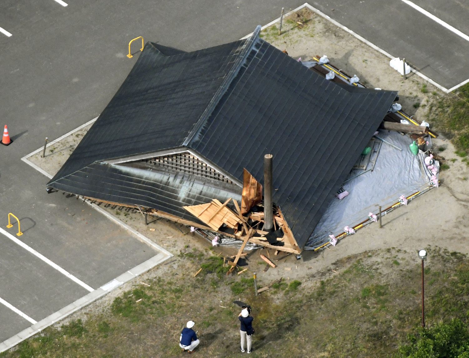
Only a few injuries were reported in Thursday’s quake, but two houses caught fire from broken gas pipes, officials said.

Water gushed from zigzagged cracks in the pavement from busted water lines. Deep fissures snaked across the Mojave Desert, with passersby stopping to take selfies while standing in the rendered earth.

The quake sent 30 residents of the desert community of 28,000 to emergency shelters, knocked some houses off their foundations and left many homeowners wondering if their insurance would cover the damage, Ridgecrest Mayor Peggy Breeden said.

“The most important thing is that we have not had any loss of life or any major personal damage to people,” Breeden told CNN on Friday.

Breeden said officials were still assessing the extent of the damage, but added that emergency state and federal aid would enable the city’s overwhelmed agencies to start the cleanup without worrying about their budgets.

The quake hit the edge of Death Valley National Park about 113 miles northeast of Los Angeles at about 10:30 a.m. on Thursday. It was very shallow, only 6.7 miles (10.7 km) deep, amplifying its effect, and was felt in an area inhabited by 20 million people, the European quake agency EMSC said.

The Ridgecrest Regional Hospital, where 15 patients were evacuated earlier, appeared intact apart from some new cracks in the walls.

The quake is the largest in Southern California since the 1994 magnitude 6.6 Northridge earthquake, USGS geophysicist Paul Caruso said. That quake, which was centered in a heavily populated area of Los Angeles, killed 57 people and caused billions of dollars of damage.

(Reporting by David McNew; additional reporting by Bill Tarrant in Los Angeles, Sandra Maler in Washington, Lisa Richwine in Los Angeles, Gabriella Borter and Daniel Trotta and Peter Szekely in New York, Lizbeth Diaz in Mexico City and Rich McKay in Atlanta; Editing by Chizu Nomiyama and Grant McCool)

Strong quake strikes northwest Japan, triggers small tsunami, power cuts

Scattered goods caused by an earthquake are seen at a supermarket in Tsuruoka, Yamagata prefecture, Japan June 19, 2019, in this photo taken by Kyodo. Mandatory credit Kyodo/via REUTERS ATTENTION EDITORS - THIS IMAGE WAS PROVIDED BY A THIRD PARTY. MANDATORY CREDIT. JAPAN OUT. NO COMMERCIAL OR EDITORIAL SALES IN JAPAN.

TOKYO (Reuters) – A strong and shallow earthquake struck Japan’s northwest coast around Niigata prefecture on Tuesday, triggering a small tsunami, shaking buildings and cutting power to around 9,000 buildings.

The magnitude 6.4 quake, according to the U.S. Geological Survey (USGS), lasted for as long as 20 seconds and damage included a landslide that struck a road, according to public broadcaster NHK. There were no initial reports of fatalities or fires.

A collapsed wooden roof of a sumo wrestling ring caused by an earthquake is seen at the Oizumi Elementary School in Tsuruoka, Yamagata prefecture, Japan June 19, 2019, in this photo taken by Kyodo. Mandatory credit Kyodo/via REUTERS ATTENTION EDITORS - THIS IMAGE WAS PROVIDED BY A THIRD PARTY. MANDATORY CREDIT. JAPAN OUT. NO COMMERCIAL OR EDITORIAL SALES IN JAPAN.

A collapsed wooden roof of a sumo wrestling ring caused by an earthquake is seen at the Oizumi Elementary School in Tsuruoka, Yamagata prefecture, Japan June 19, 2019, in this photo taken by Kyodo. Mandatory credit Kyodo/via REUTERS ATTENTION EDITORS – THIS IMAGE WAS PROVIDED BY A THIRD PARTY. MANDATORY CREDIT. JAPAN OUT. NO COMMERCIAL OR EDITORIAL SALES IN JAPAN.

Authorities lifted a 0.2-1.0 meter tsunami warning for the region after waves several centimeters high struck parts of the Niigata coast.

A tsunami of up to one meter could have caused some flooding and damage in low-lying coastal areas and river banks, though much of Japan’s coastline is guarded by sea walls.

“We will work closely with local authorities to provide any disaster measures including lifesaving and rescue operations and have instructed officials to provide information in a timely and accurate manner,” Chief Cabinet Secretary Yoshihide Suga – the top government spokesman – told a media briefing.

The quake struck at 10.22 p.m. local time (1322 GMT Thursday) at a depth of 12 kilometers (7.5 miles), the USGS said.

It measured 6.7 according to the Japan Meteorological Agency, and in some places was as high as a strong six on the agency’s seven-point “Shindo”, or Seismic Intensity Scale, which measures ground motion at specific points unlike magnitude which expresses the amount of energy released.

Tokyo Electric Power Co’s (Tepco) Kashiwazaki-Kariwa nuclear plant was not affected by the quake, which hit 85 km ( 53 miles) northeast of the site. All of its seven reactors were already shut down, NHK said.

A Tepco spokesman said an initial inspection showed no damage to the plant, and inspectors would carry out more detailed checks.

The quake also temporarily halted express bullet train services in the region, with some roads also closed, according to NHK.

(Reporting by Tim Kelly, Elaine Lies, Linda Sieg, Takaya Yamaguchi and Yuka Obayashi; Editing by Catherine Evans and John Stonestreet)

Deep 7.5-magnitude quake hits Ecuador-Peru border region

People gather outside the hospital after an earthquake in Guayaquil, Ecuador February 22, 2019 in this image obtained from social media. Edison Manjarrez via REUTERS

By Alexandra Valencia and Mitra Taj

QUITO/LIMA (Reuters) – A deep magnitude-7.5 earthquake struck the Peru-Ecuador border region early on Friday morning, the U.S. Geological Survey said, causing tremors that the Ecuadorian president said were felt around the country.

The quake’s epicenter was in a sparsely populated area 224 km (140 miles) east-southeast of Ambato, Ecuador, at a depth of 132 km. The USGS’s initial reading assessed the quake, which occurred at 5:17 a.m. local time (1017 GMT), at magnitude 7.7.

There was no risk of a tsunami being triggered, according to the Pacific Tsunami Warning Center, and there were no initial reports of casualties or damage.

Ecuadorian President Lenin Moreno said on Twitter that preliminary reports “do not indicate major damage,” though he added that provincial response teams had been activated and that the tremors had been “felt throughout the country.”

One resident in Cuenca, Ecuador, 253 km (157 miles) from the epicenter, described the temblor as very strong, while a second resident there reported experiencing “a good 30-second shake,” according to witness statements on the European-Mediterranean Seismological Center website.

Ecuador’s emergency response service said the main quake and other smaller ones had shook the south of the country with reports of some minor injuries, evacuation of patients and staff from several hospitals and damage reported in some Amazonian towns.

Some areas were without electrical power, authorities said, while the country’s oil pipelines and hydroelectric dams were operating normally.

In towns near the epicenter of the quake, the tremors caused alarm. “I felt the walls and the floor move. I was very scared and we went out to the street,” Lissette Alarcon, a 25-year-old university student, told Reuters.

“We still aren’t used to these earthquakes,” she said.

A magnitude-7.1 earthquake struck Peru’s southern coast in January 2018, killing one person, injuring scores more and causing roads and homes to collapse. A 7.8-magnitude quake in Ecuador killed around 700 people in 2016.

(Reporting by Mitra Taj in Lima, Alexandra Valencia in Quito and Jason Neely and John Stonestreet in London; Writing by Adam Jourdan; Editing by Alison Williams and Jeffrey Benkoe)

Minor explosion at Hawaii volcano spews more ash into the air

FILE PHOTO: Journalists and National Guard soldiers watch as lava erupts in Leilani Estates during ongoing eruptions of the Kilauea Volcano in Hawaii, U.S., June 9, 2018. REUTERS/Terray Sylvester

(Reuters) – Another small explosion at the summit of Hawaii’s Kilauea Volcano shot more ash high into the atmosphere, putting communities in the southern part of the Big Island at risk, the U.S. Geological Survey (USGS) said.

The volcano, which has been erupting since early May, has sent occasional columns of ash and volcanic gas into the atmosphere at between 10,000 (3,050 meters) and 30,000 feet (9,145 meters) above sea level, it said.

On Sunday, another explosion spewed ash from the volcano, creating a driving hazard for roads on parts of the Big Island.

A fissure in the volcano spewed molten rock 160 feet (49 meters) on Tuesday, slightly lower than the 180 feet (55 meters) it reached from Saturday night into Sunday, pushing a steady flow of lava into the ocean, the USGS said.

A representative for the Hawaii Emergency Management Agency did not immediately respond to a request for comment.

The eruption, which entered its 40th day on Tuesday, stands as the most destructive in the United States since at least the violent 1980 eruption of Mount St. Helens in Washington state that reduced hundreds of square miles to wasteland and killed nearly 60 people, according to geologist Scott Rowland, a volcanologist at the University of Hawaii at Manoa.

The Hawaii eruption has caused no casualties, but lava flows have swallowed about 600 homes since May 3, Hawaii County Mayor Harry Kim said last week.

Vacationland, a private development believed to comprise about 160 homes, was completely erased, and at least 330 houses were devoured by lava at Kapoho Beach Lots, Kim said.

On Saturday, hundreds of construction workers and volunteers, including officials from the Hawaii National Guard and the Hawaii Regional Council of Carpenters, began building 20 temporary housing units in Pahoa for families forced from their homes.

(Reporting by Gina Cherelus in New York; Editing by Bill Berkrot)

Vertical plume of ash explodes from Hawaii volcano, hundreds ordered to leave vicinity

Volcanic gases rise from the Kilauea lava flow that crossed Pohoiki Road near Highway 132, near Pahoa, Hawaii, U.S., May 28, 2018. REUTERS/Marco Garc

HONOLULU (Reuters) – A small explosion of ash erupted from the summit of Hawaii’s Kilauea volcano early on Tuesday morning in a vertical plume some 15,000 feet (4,600 meters) high, the U.S. Geological Survey said, the latest outburst in a month of volcanic activity.

The agency warned that ash was drifting northwest and liable to dust anyone in the summit area. Hundreds of people have been ordered to leave the vicinity of the biggest eruption cycle in a century of one of the world’s most active volcanoes.

A news reporter takes pictures of the Kilauea lava flow that crossed Pohoiki Road near Highway 132, near Pahoa, Hawaii, U.S., May 28, 2018. REUTERS/Marco Garcia

A news reporter takes pictures of the Kilauea lava flow that crossed Pohoiki Road near Highway 132, near Pahoa, Hawaii, U.S., May 28, 2018. REUTERS/Marco Garcia

Multiple fissures continue to spew up hot lava flows, which have blocked roads and damaged dozens of buildings on Hawaii’s Big Island.

One fountain of lava rose more than 200 feet (60 meters) at times on Monday, the Geological Survey said.

Officials are on high alert for occasional earthquakes, though none have been big enough so far to trigger a tsunami.

Lava has engulfed the heads of two wells that tap into steam and gas deep in the Earth’s core at the 38-megawatt Puna Geothermal Venture. Its operator, Israeli-controlled Ormat Technologies Inc, said it had not been able to assess the damag

So far no deaths have been blamed on the eruption, though a man’s leg was shattered when he was hit by a spatter of super-dense lava.

Residents fear the wells may be explosive. Officials have said the power plant is safe but lava has never engulfed a geothermal plant anywhere in the world, creating a measure of uncertainty.

Contingency plans have been made for a possible helicopter evacuation of up to 1,000 residents in a coastal area south of the fissures should their last exit route, be blocked by lava or become unsafe due to gaping cracks, County of Hawaii officials said.

At least 82 homes have been destroyed in the southeastern corner of Big Island and about 2,000 people have been ordered evacuated since Kilauea began erupting on May 3.

(Reporting by Jolyn Rosa; writing and additional reporting by Jonathan Allen; Editing by Scott Malone and Jonathan Oatis)

Earthquake in Gulf of Alaska sparks brief California tsunami fears

Vehicles are seen during a tsunami warning evacuation in Kodiak, Alaska, U.S., January 23, 2018 in this still image obtained from social media video. Instagram @JUPITERTHEPRODUCER.ASTORIA via REUTERS

By Yereth Rosen

ANCHORAGE (Reuters) – Alaska and parts of western Canada braced for a possible tsunami on Tuesday after a magnitude-7.9 earthquake struck the Gulf of Alaska, sparking evacuations in coastal Alaska and a tsunami warning for California that was later lifted.

In Alaska, people packed into high schools and other evacuation centers after the quake hit shortly after midnight local time (0900 GMT).

Officials had warned residents as far south as San Francisco to be ready to evacuate coastal areas but later lifted tsunami watches for California, Oregon and Washington states as well as coastal British Colombia in Canada.

In Alaska, where a tsunami advisory remained in place as of 3:12 a.m. local time (1212 GMT).

Residents gathered in shelters on Kodiak Island, the closest land point to the quake, around 160 miles (250 km) southeast of Chiniak, Alaska, at a depth of 25 km – considered shallow but with broader damage – according to the U.S. Geological Survey.

There were no immediate reports of injuries or damage from the quake, which was initially measured at magnitude 8.2.

“People are fine,” said Neil Hecht, assistant principal of Kodiak High School, which was sheltering a few hundred people. “Spirits are high. Everyone is doing well here.”

Long lines of traffic formed in coastal communities including Homer and Seward, Alaska, residents warned on social media.

In Homer, a few hundred cars were packed into its high school parking lot. Shawn Biessel, a 32-year-old park ranger, and his mother were in the lot, a few hundred feet above sea level.

“It was a really obvious, pretty strong, long quake. A good rumbler,” Biessel said in a phone interview. “It went on for a solid minute and after a while we thought we should get outside.”

Police drove through Biessel’s neighborhood with flashing lights to alert residents to evacuate, Biessel said.

“Please heed local warnings to move inland or to higher ground,” Alaska Governor Bill Walker said in a statement.

San Francisco’s Department of Emergency Management briefly warned residents within three blocks of the Pacific Ocean or five blocks of San Francisco Bay to prepare to evacuate. That warning was lifted when the tsunami watch was lifted.

An initial tsunami watch for Hawaii was canceled.

Japan’s meteorological agency said it was monitoring the situation but did not issue a tsunami alert.

(Additional reporting by Brendan O’Brien in Milwaukee and Andrea Hopkins in Ottawa; Writing by Scott Malone and Robin Pomeroy; Editing by John Stonestreet and Jeffrey Benkoe)

Oklahoma Sees Over 150 Quakes In A Week

The Oklahoma Geological Survey is reporting that over 150 earthquakes took place last week in the state.

According to data from the United States Geological Survey, Oklahoma would only experience three or fewer 3.0 or greater magnitude earthquakes in a year.  In the firt two months of 2014, over 25 quakes topped that level.

An earthquake expert Michael Lewchuk says that likely one seismic event can trigger many other events.  Last week, a dozen of the earthquakes above 2.5 on the Richter scale all took place around Liberty Lake near Guthrie, Oklahoma.

One local resident said the ongoing quakes impact “like a bomb going off” and that they are causing quakes in the foundations of homes.

It’s not only Oklahoma experiencing quake issues.  Kansas governor Sam Brownback has issued an order calling for a public safety study on oil and gas drilling’s connection to quakes.   Texas and Arkansas have also been looking into the connection.