Hurricane Matthew slams into western Haiti with deadly waves

A saleswoman shows lamps to a customers while other people flock to the supermarket to take care of last minute shopping as Hurricane Matthew approaches in Kingston, Jamaica

By Makini Brice

LES CAYES, Haiti (Reuters) – The fiercest Caribbean storm in almost a decade ripped into Haiti’s southwestern peninsula early on Tuesday with 145 mile-per-hour (230 kph) winds and storm surges that killed at least one person and damaged homes.

The eye of the violent Category 4 storm made landfall near Les Anglais on the western tip of Haiti at 7 a.m EDT, the U.S. National Hurricane Center said, pounding coastal villages with strong gusts.

One man died when a wave crashed through his home in the beach town of Port Salut, Haiti’s civil protection service said. He had been too sick to leave for a shelter, officials said. A fisherman also was missing, they said.

Overnight, Haitians living in vulnerable coastal shacks on the Tiburon Peninsula frantically sought shelter as Matthew closed in, bringing heavy rain and driving the ocean into seaside towns.

About 3 feet (1 meter) of rain is forecast to fall over denuded hills prone to flash floods and mudslides, threatening villages as well as shanty towns in the capital Port-au-Prince, where heavy rain fell overnight.

Life-threatening flash floods and mudslides were likely in southern and northwestern Haiti, the hurricane center said. It expected Matthew to remain a powerful hurricane through at least Wednesday night.

The outer bands of the cyclone already had reached the area late on Monday, flooding dozens of houses in Les Anglais when the ocean rose, the mayor said. In the town of Les Cayes on the southern coast, the wind bent trees and the power went out.
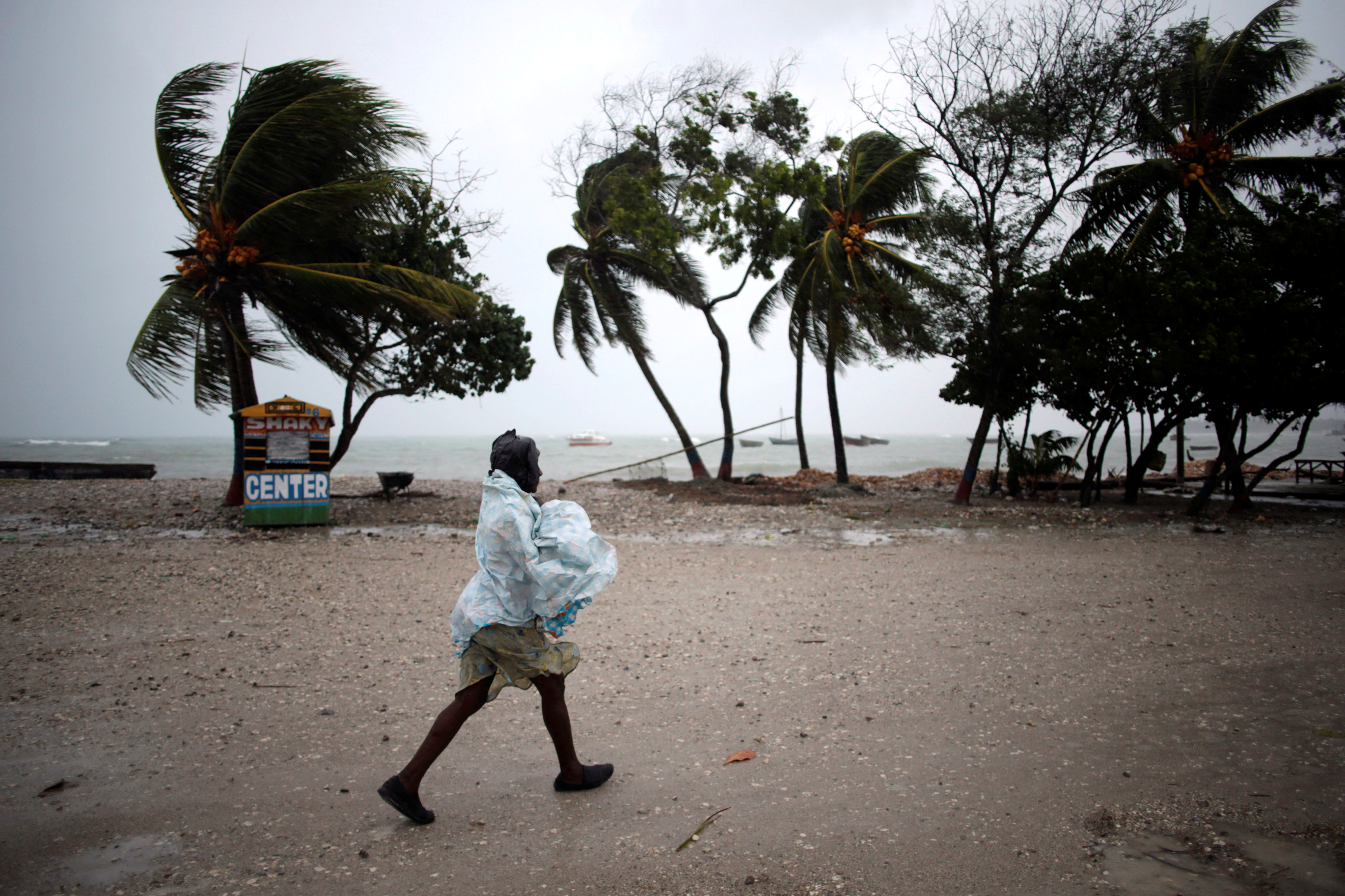
A woman protects herself from rain as Hurricane Matthew approaches in Les Cayes, Haiti. REUTERS/Andres Martinez Casares

A woman protects herself from rain as Hurricane Matthew approaches in Les Cayes, Haiti. REUTERS/Andres Martinez Casares


CHILDREN, PRISONERS MOVED

“We have gusts of wind hitting the whole area and the people have fled to a shelter,” Les Anglais mayor Jean-Claude Despierre said.

In the nearby town of Tiburon, the mayor said people who had been reluctant to leave their homes also ran for cover when the sea rose.

“Everyone is trying to find a safe place to protect themselves, the situation is very difficult,” Mayor Remiza Denize said, describing large waves hitting the town.

Poor Haitians are often reluctant to leave home in the face of storms, fearing their few belongings will be stolen.

Civil protection authorities said 130 children were evacuated by bus to a high school in the capital from an orphanage in the shoreside Cite Soleil slum, made up of tin shacks and open sewers and known as Haiti’s largest shanty town.

On the northern coast, about 300 detainees were transferred from a prison near the sea in the town of Jeremie, the Interior Ministry said.

The cyclone comes at a bad time for Haiti, where tens of thousands of people still live in tents after a 2010 earthquake that killed upwards of 200,000 people.

Cholera introduced by U.N. peacekeepers is expected to rise in the October rainy season, and the country was due to hold a long-delayed presidential election on Oct. 9.

The office of Interim President Jocelerme Privert said there was no change to the election date.

Crawling north at about 9 miles-per-hour (15 kph), the strongest storm since Hurricane Felix in 2009 threatens to linger long enough for its winds and rain to cause great damage in Haiti, where it will spend much of the day before hitting Cuba and the Bahamas later on Tuesday.

It will possibly reach Florida by Thursday as a major hurricane, although weaker than at present, the hurricane center said. Governor Rick Scott declared a state of emergency for Florida on Monday, designating resources for evacuations and shelters and putting the National Guard on standby.

CUBA PREPARES

In Les Cayes about 150 people huddled without electricity or food in the town’s largest shelter, a school.

“Since yesterday we’ve had nothing … We must sleep on the floor … Everyone is hungry,” said Erick Cange, 69 years old, a resident of the La Savanne neighborhood surrounding the school.

The conditions in the shelter compared unfavorably with Haiti’s neighbor Cuba, where authorities spent days organizing teams of volunteers to move residents to safety and secure property.

The storm is expected to make a direct hit later on Tuesday in the province of Guantanamo, the disputed home to a U.S. Naval base and military prison but also a small Cuban city. The U.S. Navy ordered the evacuation of 700 spouses and children of service personnel as the storm approached.

Guantanamo’s mountainous terrain is the country’s second coffee producer after nearby Santiago, and the storm poses a major threat to the current harvest.

The U.S. Agency for International Development said on Monday it was providing a combined $400,000 in aid to Haiti and Jamaica. The agency said in a statement it had pre-positioned relief supplies and was preparing to ship in additional supplies to the central Caribbean.

(Reporting by Joseph Guyler Delva in Port-au-Prince and Maini Brice in Les Cayes; Additional reporting by Sarah Marsh in Cuba and Brendan O’Brien in Milwaukee; Writing by Frank Jack Daniel; Editing by Simon Gardner and Bill Trott)

Hurricane Matthew’s threat to Haiti grows, some resist shelters

Families aboard a plane to evacuate them

By Makini Brice and Joseph Guyler Delva

LES CAYES/PORT-AU-PRINCE (Reuters) – Hurricane Matthew edged closer to Haiti on Monday, bringing 130- mile-per-hour (215 kph) winds and torrential rain that could wreak havoc in the Caribbean nation, although some 2,000 people in one coastal town refused to evacuate.

Matthew’s center is expected to near southwestern Haiti and Jamaica on Monday night, the U.S. National Hurricane Center said.

Crawling towards Haiti’s Les Cayes, Jamaica and Cuba at five miles per hour (seven kph), the storm could be just as slow leaving, giving its winds and rain more time to cause damage.

“We are worried about the slow pace of Hurricane Matthew, which will expose Haiti to much more rain, and the country is particularly vulnerable to flooding,” said Ronald Semelfort, director of Haiti’s national meteorology center.

The storm comes at a bad time for Haiti. The poorest country in the Americas is set to hold a long-delayed election next Sunday.

A combination of weak government and precarious living conditions make the country particularly vulnerable to natural disasters. More than 200,000 people were killed when a magnitude 7 earthquake struck in 2010.

“Even in normal times, when we have rain we have flooding that sometimes kills people,” said Semelfort, comparing Matthew to 1963’s Hurricane Flora, which swept away entire villages and killed thousands in Haiti.

RESISTANCE

In Jamaica too, officials were scrambling to protect the vulnerable, as residents boarded up windows and flocked to supermarkets to stock up on food, water, flashlights and beer.

In Cuba, which Matthew is due to reach on Tuesday, evacuation operations were well underway, with people voluntarily moving their belongings into neighbors’ houses or heading to shelters. Some even found cliff-side caves they said were the safest places to ride out storms.

Matthew was about 245 miles (3955 km) south-southeast of Jamaica’s Kingston early on Monday and moving north toward Haiti. The hurricane center ranked it at Category 4 on the five-step Saffir-Simpson scale of hurricane intensity.

In Haiti, some streets were already flooded in Les Cayes, a town of about 70,000 people that was previously ravaged by hurricanes in 1781 and 1788.

But Haitian officials said about 2,000 residents of the La Savane neighborhood of Les Cayes refused to heed government calls to move out of their seaside homes, even though they were just a few miles from where the center of the hurricane is forecast to make landfall.

As the wind died down at night, people remained outside in La Savane, hanging out on porches, playing checkers and dominoes outside, and listening to music.

“The police and local authorities and our evacuation teams have been instructed to do all they can to move those people,” Interior Minister Francois Anick Joseph said.

“They have also been instructed to move them by force if necessary. We have an obligation to protect those peoples lives, even against their will.”

However, the chief of police for the southern region, Luc Pierre, said it was almost impossible to force such a large number of people to leave their homes.

“I would have to arrest all those people and take them to a safe place. This is very difficult,” he said, adding that the power had already gone off in the town.

Poor Haitians are at times reluctant to leave their homes in the face of impending storms, fearing their belongings will be stolen after they leave.

Only a few families had opted to move to a high school in La Savane, designated as a shelter for up to 600 people. It was without electricity and lit only by candlelight.

“There are babies crying here; there is nothing at all,” said Nadja, 32, who was pregnant with her fourth child.

(Additional reporting by Sarah Marsh and Gabriel Stargardter; Writing by Frank Jack Daniel; Editing by Simon Cameron-Moore, Larry King)

Hurricane Matthew strengthens in the Caribbean

By Makini Brice

PORT-AU-PRINCE (Reuters) – Hurricane Matthew strengthened on Friday into the Caribbean’s first major hurricane in four years as it moved towards Jamaica, Haiti and Cuba with winds of up to 115 miles per hour (185 km/h) that could cause devastating damage, forecasters said.

Matthew was about 495 miles (800 km) southeast of Kingston, Jamaica, and the U.S. National Hurricane Center (NHC) designated it as Category 3 on the Saffir-Simpson scale of hurricane intensity.

It is forecast to make landfall as a major storm on Monday on Jamaica’s palm-fringed southern coast, home to tourist resorts as well as the capital and Jamaica’s only oil refinery.

The last major hurricane in the region was Sandy, in 2012.

In Haiti, which has been hard hit by natural disasters in the past, officials said preparation efforts were focussed in the south of the country. Matthew is forecast to skim past the south coast on Monday.

“We will prepare with drinking water for the patients, with medication, with generators for electricity, available vehicles to go look for people at their homes,” said Yves Domercant, the head of the public hospital in Les Cayes in the south.

In Cuba, which has a strong track record of keeping its citizens out of harms way when storms strike, residents of the eastern coastal city of Santiago de Cuba said they were tracking the news closely, although skies were still blue.

“We don’t know yet exactly where it will go, so we’re still waiting to see,” said Marieta Gomez, owner of Hostal Marieta, who was following the storm closely on TV and radio. “We Cubans are well prepared.”

The storm killed one person in St. Vincent and the Grenadines earlier in the week.

(Reporting by Makini Brice, additional reporting by Sarah Marsh in Havana and Vijaykumar Vedala in Bengaluru; Writing by Frank Jack Daniel; editing by Grant McCool)

Storm Julia weakens into a depression, meandering off of U.S. coast

Map of Tropical Storm Julia

(Updates with details)

Sept 15 (Reuters) – Tropical Storm Julia weakened into a depression and is expected to meander off the coast of Georgia and South Carolina for the next few days, the U.S. National Hurricane Center said on Thursday.

Julia is located about 60 miles (95 km) south-southeast of Charleston, South Carolina with maximum sustained winds of 35 mph (55 kph), the Miami-based weather forecaster said.

“A slow and erratic motion is expected over the next couple of days, and the track forecast keeps Julia meandering offshore of the Georgia and southern South Carolina coastlines into Saturday,” the NHC said.

Julia, the 10th named storm of the 2016 Atlantic hurricane season, was moving northeast at 2 mph just off the U.S. coast, as little change TO its strength was expected during next two days, it said.

Heavy rain combined with high tides raised concerns of flooding in downtown Charleston, South Carolina, and other coastal parts of the state into Thursday morning, forecasters said.

Some residents in coastal communities were offered sandbags to prepare for flooding in low-lying areas.

Since late Tuesday, Julia has dumped heavy rains and toppled trees in the region, but has not caused significant damage, the National Weather Service said.

On Thursday morning, the hurricane center also was tracking a tropical depression that was expected to bring heavy rains to the Cape Verde islands off West Africa. On its forecasted track, the system would remain far away from the coastal United States through early next week.

(Reporting by Karen Rodrigues in Bengaluru and Brendan O’Brien
in Milwaukee; Editing by Alison Williams)

Hermine lingers off U.S. East Coast

A woman walks her dog at Rockaway Beach in Queens, New York on Labor Day while high waves reached the shore due to post-tropical cyclone Hermine which tracked off the east coast of the U.S.

Reuters) – Hermine, a storm that raked Florida with hurricane-force winds last week, lingered on Tuesday off the U.S. East Coast where it was expected to produce heavy gusts and rain over the next two days.

Forecasters warned swimmers and boaters to stay out of treacherous waters and rough surf. New York City said all public beaches would be closed through Tuesday because of “life-threatening” rip currents.

At 2 a.m. EDT on Tuesday, Hermine’s center was about 110 miles (175 km) southeast of the eastern tip of Long Island and expected to move northwest at about 9 mph (15 kph).

Hermine was forecast to bring up to 2 inches (5 cm) of rain to Rhode Island and southern Massachusetts through Wednesday, the National Weather Service said.

A tropical storm warning remained in effect from the eastern end of New York’s Long Island and to Martha’s Vineyard and Nantucket Island off Massachusetts.

On Cape Cod and its islands, high surf and wind put a crimp in the Labor Day plans of many people looking to celebrate summer’s end, but some beaches farther south reopened.

Hermine was classified as a Category 1 hurricane when it slammed into Florida’s Gulf Coast on Friday. It became a post-tropical storm by week’s end after its winds dropped below 74 miles per hour (119 kph) and it lost its tropical characteristics.

The storm, which crossed northern Florida and then moved up the Georgia and the Carolina coasts, was packing sustained surface winds of up to 65 mph (100 kph) with higher gusts, the National Weather Service said.

“Just because it’s a post-tropical cyclone doesn’t mean the impact of tropical force winds, winds in general and storm surge go away,” said National Hurricane Center spokesman Dennis Feltgen.

The storm has claimed at least three lives, in Florida and in North and South Carolina. The third reported death was that of a man struck by a car on a South Carolina highway on Friday as he tried to move a fallen tree, a Colleton County fire department spokesman said.

Hermine became the first hurricane to make landfall in Florida in 11 years, packing winds of 80 mph (130 kph), and knocking out power to 300,000 homes and businesses.

(Reporting by Brendan O’Brien in Milwaukee)

Tropical Storm Hermine pounds into the Carolinas

Three storm systems are shown (L TO R) Tropical Depression Nine to the southeast of Florida,

By Letitia Stein

TAMPA, Fla., Sept 2 (Reuters) – Hurricane Hermine wreaked havoc across Florida on Friday, causing widespread power outages and flooding before diminishing into a tropical storm and plowing up the Atlantic Coast into the Carolinas with a still-potent mix of high winds and heavy rains.

The first hurricane to make landfall in Florida in 11 years Hermine swept ashore early on Friday near the Gulf shore town of St. Marks, 20 miles (30 km) south of the capital of Tallahassee, packing winds of 80 mph (130 kph) and churning up a devastating storm surge in coastal areas.

Torrential downpours and high surf left parts of some communities under water early Friday, with mandatory evacuations ordered in parts of five northwestern Florida counties.

State officials said electricity had been knocked out to nearly 300,000 homes and businesses by afternoon.

One storm-related death was reported by authorities in the northern Florida town of Ocala, where a fallen tree killed a homeless man sleeping in his tent.

Hermine was expected to snarl Labor Day holiday travel as it churned northeast for several more days after battering Florida’s $89 billion tourism industry.

While maximum sustained winds had weakened to 50 mph (80 kph), the tempest headed to the Atlantic seaboard along a path inhabited by tens of millions of Americans, prompting storm
watches and warnings as far north as Rhode Island.

As of 9 p.m. EDT (0100 GMT), the fourth named storm of the 2016 Atlantic hurricane season was passing near Myrtle Beach, South Carolina, leaving some 51,000 power outages across the state, said state emergency management spokesman Derrec Becker.

Becker said localized flooding hit low-lying areas across the state, and there were widespread reports of “downed power lines, downed trees, trees on cars and some flooded cars,” along with isolated incidents of tree-damaged homes.

One mobile home was virtually sliced in two by a fallen tree, but authorities had no reports of serious storm-related injuries or fatalities, Becker added.

Likewise, emergency officials reported no storm deaths in Georgia, which Hermine swept through on its way to South Carolina, but said at least 100,000 utility customers were
without power at one point.

Emergency declarations remained in effect for all or parts of Florida, Georgia, North Carolina, Virginia and Maryland.

LIKELY TO REGAIN STRENGTH

The storm was projected to creep north along the Carolina coast Friday night, then gather strength after moving offshore into the Atlantic on Saturday morning, possibly reaching near-hurricane intensity by late Sunday, according to the National Hurricane Center.

In addition to powerful winds extending up to 185 miles (295 km) from its center, Hermine was expected to unleash a dangerous storm surge in the Hampton Roads area of tidewater Virginia, where flooding could become 3 to 5 feet deep, the NHC warned.

The storm also could douse several southeastern and mid-Atlantic states with up to 15 inches (38 cm) of rain through Sunday, the agency said.

New Jersey, still mindful of devastation from superstorm Sandy in 2012, was on high alert as emergency officials advised residents to prepare for flooding, high winds and a surge of
seawater.

New York Governor Andrew Cuomo on Friday activated his state’s emergency operations center and ordered officials to stockpile resources, including sandbags and generators.

New York City Mayor Bill De Blasio said residents should avoid beach waters for fear of life-threatening riptides. “I say that to people who go the beach, I say that to surfers: Don’t even think about it,” De Blasio told reporters.

In Florida, concerns over the standing water in which mosquitoes breed intensified as the state battled an outbreak of the Zika virus.

“It is incredibly important that everyone does their part to combat the Zika virus by dumping standing water, no matter how small,” Florida Governor Rick Scott told a news conference.

Overnight, crews in Pasco County, Florida, rescued more than a dozen people after their homes were flooded.

Richard Jewett, 68, was rescued from his home in New PortRichey, just north of Tampa, as emergency teams carried out amandatory evacuation.

“The canal started creeping up toward the house, and even though it wasn’t high tide it looked like it was coming inside,” Jewett said.

(Additional reporting by Zachary Fagenson in Hudson Beach,
Fla., Steve Gorman in Los Angeles, Brendan O’Brien in Milwaukee,
Laila Kearney in New York and Jon Herskovitz in Austin; Editing
by Daniel Trotta and Cynthia Osterman)

Hermine hammers Florida, leaving thousands without power

Three storm systems

(Updates with Hermine being downgraded to tropical storm)

By Letitia Stein

TAMPA, Fla., Sept 2 (Reuters) – Wind and rain from Hurricane
Hermine slammed Florida’s northern Gulf Coast before it weakened
to a tropical storm and ploughed its way overland towards the
Atlantic Coast on Friday.

Hermine made landfall early on Friday, bringing heavy rains
and packing winds of 80 mph (130 km/h), causing damage and
leaving tens of thousands of households without power along
Florida’s Gulf Coast.

“It is a mess…we have high water in numerous places,”
Virgil Sandlin, the police chief in Cedar Key, Florida, told the
Weather Channel.

Strong gusts downed power lines and trees as widespread
flooding inundated communities in Florida before the hurricane
weakened into a tropical storm as it reached Georgia and South
Carolina, where conditions deteriorated early on Friday morning.

“The combination of a dangerous storm surge and the tide
will continue to cause normally dry areas near the coast to be
flooded by rising waters moving inland from the shoreline,”
the National Hurricane Center said.

The center warned that some areas along Florida’s northern
Gulf Coast may experience 9 feet (3 m) of flooding.

Florida Governor Rick Scott said the storm could lead to
deaths and told residents to stay indoors until it had passed.

Pasco County reported crews rescued 18 people and brought
them to shelters after their homes were flooded in Green Key and
Hudson Beach early on Friday.

“Stay indoors even if it calm outside. The eye of Hermine
may be passing through. Let it pass completely before surveying
any damage,” Governor Scott advised residents in a Twitter post.

Hermine became the fourth hurricane of the 2016 Atlantic
storm season. By 11 p.m. EDT, maximum winds were listed at 80
mph (130 kph), with hurricane-force winds extending up to 45
miles (75 km) from the storm’s center.

Hermine could dump as much as 20 inches (51 cm) of rain in
some parts of the state. Ocean storm surge could swell as high
as 12 feet (3.6 meters).

Scott declared a state of emergency in 51 of Florida’s 67
counties, and at least 20 counties closed schools.

Mandatory evacuations were ordered in parts of five counties
in northwestern Florida, with voluntary evacuations in at least
three more counties. Twenty emergency shelters were opened
across the state for those displaced by the storm.

“This is life-threatening,” Scott told reporters on
Thursday.

In coastal Franklin County, people were evacuated from
barrier islands and low-lying shore areas.

“Those on higher ground are stocking up and hunkering down,”
Pamela Brownlee, the county’s emergency management director,
said.

The National Weather Service issued tornado and tropical
storm watches and warnings for communities throughout northern
Florida and north along Atlantic Coast, where it posed a Labor
Day weekend threat for tens of millions of people.

On its current path, the storm also could dump as much as 10
inches (25 cm) of rain on coastal areas of Georgia, which was
under a tropical storm watch, and the Carolinas. Forecasters
warned of “life-threatening” floods and flash floods there.

The governors of Georgia and North Carolina on Thursday
declared emergencies in affected regions. In South Carolina, the
low-lying coastal city of Charleston was handing out sandbags.

(Additional reporting by Brendan O’Brien in Milwaukee, Laila
Kearney in New York and Jon Herskovitz in Austin, Editing by
Angus MacSwan)

Hurricane warning issued for parts of Florida; Madeline weakens

A city worker fills sandbags to help residents prepare for an expected tropical storm in Gulfport, Florida

TAMPA BAY, Fla. (Reuters) – Forecasters and public officials urged Floridians to prepare for potentially catastrophic flooding and damaging winds as Tropical Storm Hermine was expected to become a hurricane by the time it reached Florida’s northern Gulf Coast on Thursday.

A hurricane warning was in effect for the Florida panhandle from the Suwannee River to Mexico Beach as the strengthening storm was expected to sweep across northern parts of the state and then northeast along the Atlantic Coast, the National Hurricane Center said in an advisory.

The forecast of rough weather prompted Florida Governor Rick Scott to declare an emergency on Wednesday as many school districts along the Gulf Coast canceled after-school activities and ordered students to stay home on Thursday.

Cities such as Tallahassee and Orlando were offering sandbags to residents to protect homes and businesses from flooding caused by the up to 10 inches (25 cm) of rain as heavy rains were already pounding parts of the state and were expected through Friday.

“There is a danger of life-threatening inundation,” said the center’s advisory that noted the possibility of as much as 20 inches (20 cm) of rain to fall in some isolated areas and life-threatening flash flooding.

The storm, packing winds of 60 mph (95 kmh) with higher gusts, was expected to get stronger by the time it reach landfall, making outside preparations difficult or dangerous, the center said.

“Heavy rainfall and strong winds will make driving dangerous. Even after the storm passes, citizens should avoid unnecessary travel to allow first responders and road clearing crews to quickly respond to emergency needs,” the City of Tallahassee said in an alert to residents.

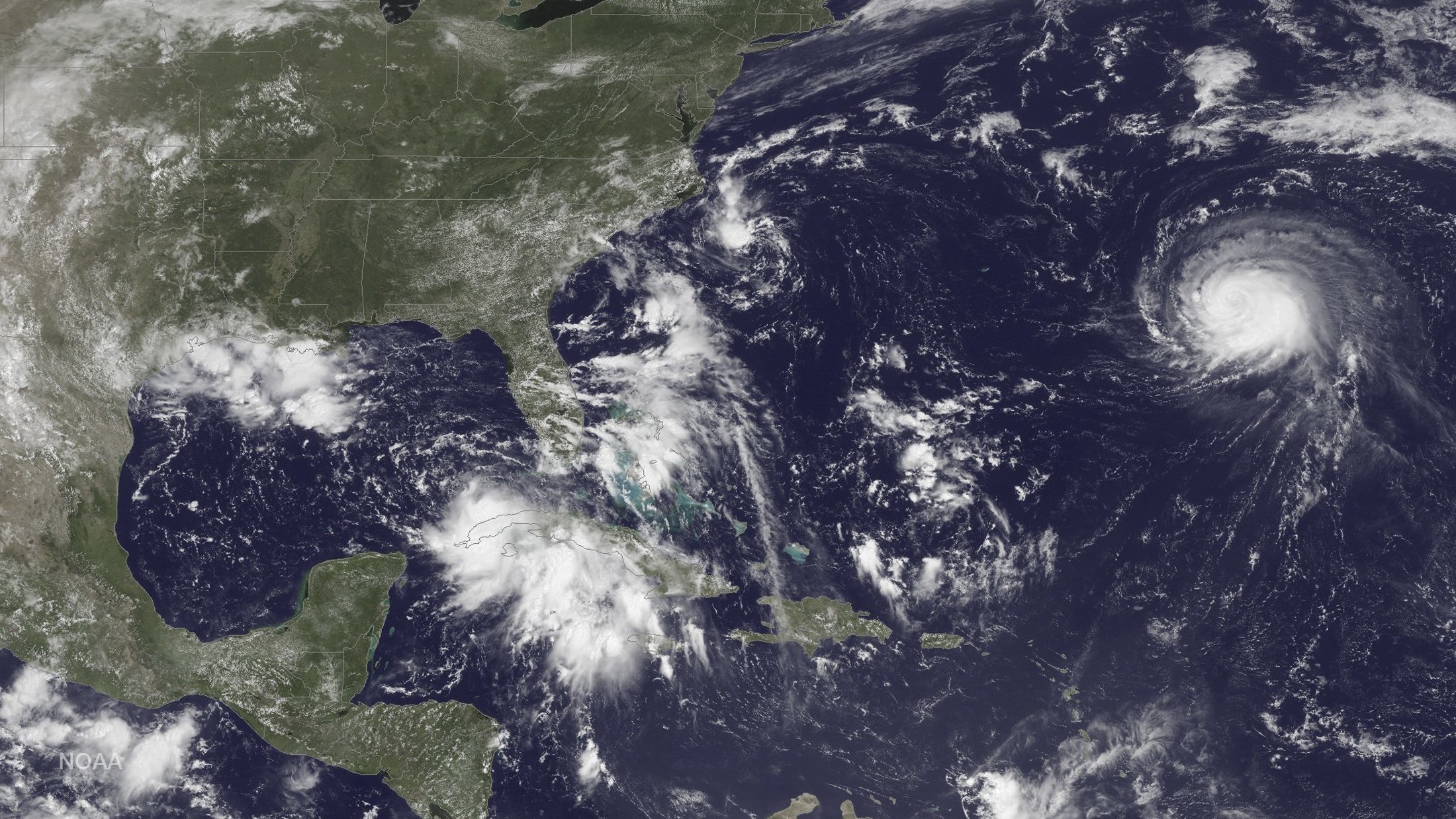
Three storm systems are shown (L TO R) Tropical Depression Nine to the southeast of Florida, Tropical Depression Eight just off the coast of the Carolinas and Hurricane Gaston in the central Atlantic Ocean are shown in this GOES East satellite image captured August 29, 2016. NOAA/handout via REUTERS

Three storm systems are shown (L TO R) Tropical Depression Nine to the southeast of Florida, Tropical Depression Eight just off the coast of the Carolinas and Hurricane Gaston in the central Atlantic Ocean are shown in this GOES East satellite image captured August 29, 2016. NOAA/handout via REUTERS

On its current path, the system would also dump as much as 10 inches (25 cm) of rain on coastal areas of Georgia, which was under a tropical storm watch, and the Carolinas.

A tropical storm warning was also issued for the U.S. east coast from Marineland, Florida to South Santee River, South Carolina, the Miami-based weather forecaster said.

U.S. oil and gas producers in the east of the Gulf of Mexico removed workers from 10 offshore platforms, moved drilling rigs and shut some output because of the storm.

The hurricane center also said in an advisory that the center of Hurricane Gaston will move near the Azores on Friday.

Meantime, Hurricane Madeline weakened to a tropical storm as it passed south of Hawaii’s Big Island, where officials opened shelters and closed offices, schools and roads on Wednesday.

The tropical storm, before it moves westward out of reach of Hawaii, was expected to dump as much as 15 inches (40 cm) of rain on parts of the Big Island, according to the National Weather Service.

Hurricane Lester, currently a major Category 4 storm, could affect Hawaii over the weekend.

Hawaii Governor David Ige signed an emergency proclamation that runs through Sept. 9, freeing up state resources.

(Reporting by Brendan O’Brien in Milwaukee; Editing by Toby Chopra)

Storm bears down on Florida, hurricane threatens Hawaii

Three storm systems are shown (L TO R) Tropical Depression Nine to the southeast of Florida, Tropical Depression Eight just off the coast of the Carolinas and Hurricane Gaston in the central Atlantic Ocean are shown in this GOES East satellite image captured August 29, 2016.

(Reuters) – Forecasters issued a tropical storm warning on Wednesday for the Florida Gulf Coast, where preparations were being made for life-threatening flooding and fierce winds, while residents of Hawaii’s Big Island were warned of an encroaching hurricane.

Some local governments in Florida have begun distributing sandbags as the unnamed tropical depression heads toward the state’s Gulf Coast where as much as 15 inches of rain could fall from Indian Pass on the panhandle along the Gulf of Mexico to north of Tampa, the National Hurricane Center said in an early morning advisory.

“Persons located within these areas should be prepared to take all necessary actions to protect life and property from rising water,” the center said.

The center also issued a hurricane watch for the coast, saying the system, which is currently packing 35 mph (55 kph) with higher gusts, is expected to strengthen as it heads east.

Flooding, storm surge, fierce winds and tornadoes were all threats to the region, which could begin feeling the storm late on Wednesday, Florida Governor Rick Scott said in a statement.

On its current path, the system could make landfall on Florida’s north-central Gulf Coast on Thursday, bringing storms into Georgia and the eastern Carolinas on its way to the Atlantic Ocean.

Florida raised the activation status of its State Emergency Operations Center on Tuesday to begin preparing.

Another unnamed tropical depression was turning out to sea on Wednesday after threatening the North Carolina coast, according to the hurricane center.

On Hawaii’s Big Island, residents were warned on Tuesday of an encroaching hurricane expected to bring strong winds and heavy rains.

The National Weather Service (NWS) tracked Hurricane Madeline swirling about 235 miles (380 km) east of the town of Hilo around 11 p.m. local time on Tuesday. The storm was forecast to “pass dangerously close” on Wednesday, prompting the NWS to issue a hurricane warning for the island.

Madeline was ranked as a Category 1 hurricane with maximum sustained winds of 90 mph (150 kph), the weather service said.

The County of Hawaii sent residents an alert about the hurricane’s dangers, including heavy rains that could lead to mudslides, as well as possibly damaging ocean swells.

“Preparations to protect life and property should be completed by nightfall today,” the alert said.

(Reporting by Brendan O’Brien in Milwaukee; Editing by Richard

Great Red Spot Storm heating Jupiter’s atmosphere

Jupiter's most distinctive feature - a giant red spot, is seen in this April 21, 2014, REUTERS/NASA, ESA,

By Irene Klotz

CAPE CANAVERAL, Fla. (Reuters) – Scientists have long wondered why Jupiter’s upper atmosphere has temperatures similar to those of Earth, even though the biggest planet in the solar system is five times farther away from the sun.

The answer may be The Great Red Spot, an enormous storm big enough to swallow three Earths that has been raging on Jupiter for at least three centuries, a study showed on Wednesday.

Using an infrared telescope at Hawaii’s Mauna Kea Observatory, scientists discovered that the upper atmosphere above the Great Red Spot – the largest storm in the solar system – is hundreds of degrees hotter than anywhere else on the planet.

It could be a coincidence or a major clue, said Boston University physicist James O’Donoghue, lead scientist of the study published in the journal Nature.

The storm spans 13,670 miles by 7,456 miles (22,000 km by 12,000 km) and is located in Jupiter’s lower atmosphere. The top of its clouds reach altitudes of about 31 miles (50 km).

By a process of elimination, the newly found hot spot must be heated from below, the study concluded.

The finding provides a strong link between Jupiter’s upper and lower atmosphere, though the exact process by which heat is transferred remains unknown. The most-likely energy source is acoustic waves that provide heat from below, the study said.

Scientists also are unsure why the storm is brick red, nor why it has changed color over time. In a 1900 report in the Seattle Post-Intelligencer, scientists described the oval storm as salmon pink. Recent images from the Hubble Space Telescope show it has become orange tinged and more circular.

Like a hurricane on Earth, the Spot’s center is relatively calm, but farther out winds reach 270 mph to 425 mph (430 kph to 680 kph). Because there is no land on Jupiter, which is made almost entirely of hydrogen and helium, the storm can never make landfall and dissipate.

“The Great Red Spot is like a wheel that’s wedged between two conveyor belts running in opposite directions,” said planetary scientist Glenn Orton, with NASA’s Jet Propulsion Laboratory in Pasadena, Calif.

“One is adding momentum to it at the top, and another is adding momentum at the bottom. Together, they feed the vortex and essentially keep it alive.”

But the storm may not be alive much longer. It has been shrinking for the last 100 years, Orton said.

More information is expected from NASA’s Juno spacecraft, which arrived at Jupiter on July 4.

(Reporting by Irene Klotz; Editing by Daniel Wallis and Alan Crosby)