New Fast-moving Los Angeles wildfire destroys homes, prompts evacuation orders

Fast-moving Los Angeles wildfire destroys homes, prompts evacuation orders
(Reuters) – Thousands of people in Los Angeles were ordered to evacuate after a fast-moving brush fire ignited early on Monday morning near the Getty Center museum, the latest outbreak in a wildfire season that has scorched parts of California.

Spot fires break out on a hillside as the Getty Fire burns in west Los Angeles, California, U.S. October 28, 2019. REUTERS/Gene Blevins

Spot fires break out on a hillside as the Getty Fire burns in west Los Angeles, California, U.S. October 28, 2019. REUTERS/Gene Blevins

The fire broke out around 1:30 a.m. (0830 GMT) and has since grown to consume more than 500 acres (202 hectares) in the scrub-covered hills around Interstate 405, near some of the city’s most expensive homes. Commuters posted videos of slopes aglow with orange flames close to the road’s edge.

At least five homes had burned down but there were no reported injuries, Mayor Eric Garcetti told reporters at a news conference with fire officials, warning that he expected the number to rise.

“This is a fire that quickly spread,” he said, urging residents in the evacuation zone, which encompasses more than 3,300 homes, to get out quickly.

Los Angeles Lakers star LeBron James, who lives in the area, said he had heeded the warning and had been driving around before dawn with his family looking for shelter.

“Finally found a place to accommodate us!” he wrote a short time later on Twitter. “Crazy night man!”

Officials at the Getty art museum said the fire was burning to the north of the building, which was designed with thick stone walls to prevent fire from damaging its treasures.

The fierce winds fanning wildfires elsewhere in the state, including a large fire consuming parts of the picturesque wine country north of San Francisco, were expected to abate on Monday.

But forecasters with the National Weather Service said high winds would return later in the week and could be the strongest so far this year in the south of the state.

Marc Chenard, a forecaster with the NWS’s Weather Prediction Center, said wind gusts in northern California would abate by midday and in the south of the state by later in the afternoon.

Wind gusts can be between 50 to 60 miles per hour (80-96 kph), with some significantly higher, he said.

The northern California wine country has borne the brunt of the fires, with 84 square miles (218 sq km) burned and 190,000 people evacuated in the Kincade fire.

Only about 5% of that fire was contained early on Monday after crews lost ground against the wind-driven wildfire a day earlier.

About 3,000 people were battling the Kincade Fire, the worst of more than a dozen major blazes that have damaged or destroyed nearly 400 structures and prompted Governor Gavin Newsom to declare a statewide emergency.

Investigators have not yet said what they believed caused the blaze, although it ignited near a broken wire on a Pacific Gas & Electric <PCG.N> transmission tower.

POWER OUTAGES

More than a million homes and businesses were without power on Monday morning, most of those from planned outages. Forecasts of high winds had prompted PG&E to shut off power to 940,000 customers in 43 counties on Saturday night to guard against the risk of touching off wildfires.

PG&E expects to issue a weather all clear for safety inspections and restoration work to begin early Monday morning for the northern Sierras and North Coast, the company said.

The governor has been sharply critical of PG&E, saying corporate greed and mismanagement kept it from upgrading its infrastructure while wildfire hazards have steadily worsened over the past decade.

PG&E filed for bankruptcy in January, citing billions of dollars in civil liabilities from deadly wildfires sparked by its equipment in 2017 and 2018.

(Reporting by Stephen Lam in Healdsburg, California, additional reporting by Jonathan Allen in New York and Rich McKay in Atlanta; Editing by Scott Malone, Steve Orlofsky and Bill Berkrot)

Calmer winds bring hope in battle against deadly California blaze

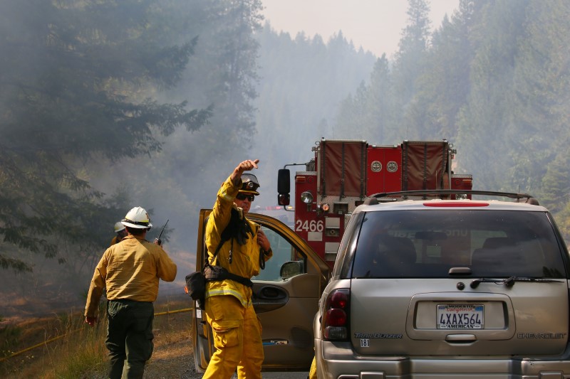
Jul 30, 2018; Redding, CA, USA; Firefighters monitor fire movement as it crosses Highway 299 just west of Buckhorn Summit near the Trinity County line. Firefighters made progress on the fire which is now at 20 percent containment. Kelly Jordan via USA TODAY NETWORK

By Bob Strong

REDDING, Calif. (Reuters) – Some 3,600 firefighters struggling against one of the most destructive wildfires in California’s history hoped calmer winds on Tuesday would allow them to make more progress in carving out buffers to contain the blaze.

Six people have been confirmed killed and seven others have been missing since last Thursday. More than 800 homes and 300 other buildings have been reduced to ash and 37,000 people forced to evacuate as the Carr fire consumed 104,000 acres (42,000 hectares) in and around the town of Redding.

Jul 30, 2018; Redding, CA, USA; Todd Abercrombie, of Cal Fire watches the fire behavior as firefighters monitor fire movement as it crosses Highway 299 just west of Buckhorn Summit near the Trinity County line. Firefighters made progress on the fire which is now at 20 percent containment. Kelly Jordan via USA TODAY NETWORK

Jul 30, 2018; Redding, CA, USA; Todd Abercrombie, of Cal Fire watches the fire behavior as firefighters monitor fire movement as it crosses Highway 299 just west of Buckhorn Summit near the Trinity County line. Firefighters made progress on the fire which is now at 20 percent containment. Kelly Jordan via USA TODAY NETWORK

The firefighters reported some progress on Monday, having carved buffer lines around 23 percent of the fire’s perimeter, up from just 5 percent during much of the past week, thanks to calmer winds expected to remain in the area for two days.

The blaze, so far the seventh most destructive in Californian history, roared without warning into Redding and adjacent communities last week after being whipped by gale-force winds into a firestorm that jumped the Sacramento River.

It is the biggest of 17 wildfires now raging across the state, fueled by drought-parched vegetation, triple-digit temperatures, and unpredictable winds.

Two firefighters and at least four civilians were killed, including two young children and their great-grandmother who perished while huddled under a wet blanket.

Whole neighborhoods, including the town of Keswick on the outskirts of Redding, were laid to waste as residents fled for their lives in a chaotic evacuation. On Monday authorities began allowing some to return home, though an estimated 37,000 people still remained under mandatory evacuation orders.

Jul 30, 2018; Redding, CA, USA; Firefighters monitor fire movement as it crosses Highway 299 just west of Buckhorn Summit near the Trinity County line. Firefighters made progress on the fire which is now at 20 percent containment. Kelly Jordan via USA TODAY NETWORK

Jul 30, 2018; Redding, CA, USA; Firefighters monitor fire movement as it crosses Highway 299 just west of Buckhorn Summit near the Trinity County line. Firefighters made progress on the fire which is now at 20 percent containment. Kelly Jordan via USA TODAY NETWORK

To the southwest, the River and Ranch wildfires, known as the 23,000-acre Mendocino Complex, has forced thousands to evacuate as it has threatened 10,000 homes. About 2,000 firefighters are battling the blazes about 150 miles (240 km)north of San Francisco, where it has destroyed seven homes since it began on Friday, fire officials said.

Collectively, wildfires that have burned mostly in the U.S. West have scorched 4.6 million acres so far this year, 24 percent more than the average of burned landscape tallied for the same period over the past decade, according to federal data.

Authorities in California have reported levels of fire intensity and unpredictability they have seldom seen before. Statewide, wildfires have charred nearly 410,000 acres since January, the highest year-to-date total for the end of July in a decade, according to CalFire.


(Additional reporting by Brendan O’Brien; Editing by Richard Balmforth)

Heavy rains force evacuation of thousands in Japan; one killed

A kimono-clad woman using a smartphone takes photos of swollen Kamo River, caused by a heavy rain, from Shijo Bridge in Kyoto, western Japan, in this photo taken by Kyodo July 5, 2018. Mandatory credit Kyodo/via REUTERS

TOKYO (Reuters) – Japan on Thursday ordered the evacuation of thousands of residents from the outskirts of its ancient capital of Kyoto after “historic” rains battered its western region, killing a man, with yet more rain forecast.

About 160,000 people were advised to evacuate across the region as weather officials warned that rain levels they described as “historic” could continue until Sunday.

“Severe caution is needed,” an official of Japan’s Meteorological Agency (JMA) told a news conference, warning of the potential for landslides and high winds.

A 59-year-old construction worker died in the western prefecture of Hyogo after being sucked into a drainage pipe, and two more were injured as they rushed to his rescue, NHK national television said.

Evacuation orders went out in some outlying parts of Kyoto, with the Kyodo news agency saying about 16,000 people were affected. Television broadcast images of the swollen waters of the Kamo River in the city center.

The heavy rains were brought by a rush of humid air from the south and the remnants of a typhoon this week.

By Thursday afternoon, rainfall of about 457 mm (18 inches) had been recorded in some parts of the smallest main island of Shikoku over the last two days, with up to 400 mm (16 inches) more predicted in some areas in the next 24 hours.

Typhoon Prapiroon churned up the Sea of Japan this week before weakening into a tropical depression. Another storm, Typhoon Maria, has formed in the Pacific and is set to strengthen, possibly targeting the southwestern islands of Okinawa early next week.

(Reporting by Elaine Lies; Editing by Clarence Fernandez)

Colorado wildfires displace thousands, prompt national forest closure

A satellite image shows the 416 Wildfire burning west of Highway 550 and northwest of Hermosa, Colorado, U.S., June 10, 2018. Satellite image ©2018 DigitalGlobe, a Maxar company /Handout via REUTERS

By Keith Coffman

DENVER (Reuters) – Firefighters battled to gain control over several large wildfires in Colorado on Tuesday, including two blazes at opposite ends of the state that have prompted the evacuation of more than 3,500 homes and the closure of a national forest.

The largest and most threatening blaze, a 12-day-old conflagration dubbed the 416 Fire, has scorched more than 23,000 acres (9,461 hectares) of drought-parched grass, brush and timber at the edge of the San Juan National Forest near the southwestern Colorado town of Durango.

Fire crews made some headway against the blaze on Tuesday, managing to extend containment lines to 15 percent of the fire’s perimeter, up from 10 percent on Monday, despite persistent hot, dry conditions and fierce winds of up to 25 miles per hour (40 km/h).

Some 2,150 dwellings remained under evacuation orders and residents of another 500 homes were advised they, too, might have to flee at a moment’s notice, La Plata County officials said. Significant rainfall was not expected before this weekend.

The 416 Fire and a separate blaze burning nearby, the so-called Burro Fire, also prompted state parks officials to close several wildlife areas to the public. The U.S. Forest Service shut down all 1.8 million acres of the San Juan National Forest to visitors on Tuesday.

However, firefighters were counting on some relief from a promising shift in weather patterns forecast for Friday, some of it associated with Hurricane Bud.

Far across the state about 60 miles (95 km) west of Denver, a newer blaze called the Buffalo Mountain fire prompted the mandatory evacuation of 1,380 homes after blackening a comparatively small area of just 100 acres, Summit County officials said.

A total of at least seven major wildfires were raging in parts Colorado on Tuesday, marking the biggest concentration of roughly 30 blazes burning across nine Western states as the 2018 summer wildfire season heated up across the region.

In southern Wyoming near the Colorado border, the so-called Badger Creek Fire in Medicine Bow National Forest grew up to 5,200 acres late Tuesday, from just 150 acres a day earlier, as evacuation orders were expanded to nearly 400 homes in Albany County, according to the Inciweb online U.S. fire information service.

(Additional reporting by Steve Gorman in Los Angeles and Bernie Woodall in Fort Lauderdale, Fla. Writing by Steve Gorman; Editing by Andrew Heavens and Steve Orlofsky)